
Maps
'n' More
Created
By
Sharon McAllister

|
|
Maps
'n' More |
|
|
|
||
|
|
|
||
|
|
|
|
|
|
|
|
|
|
|
|
|
|
|
|
|
|||
| Back to Hughes County Township Maps | Back to Hughes County Cemetery Lists |
Hughes - T7N-R11E
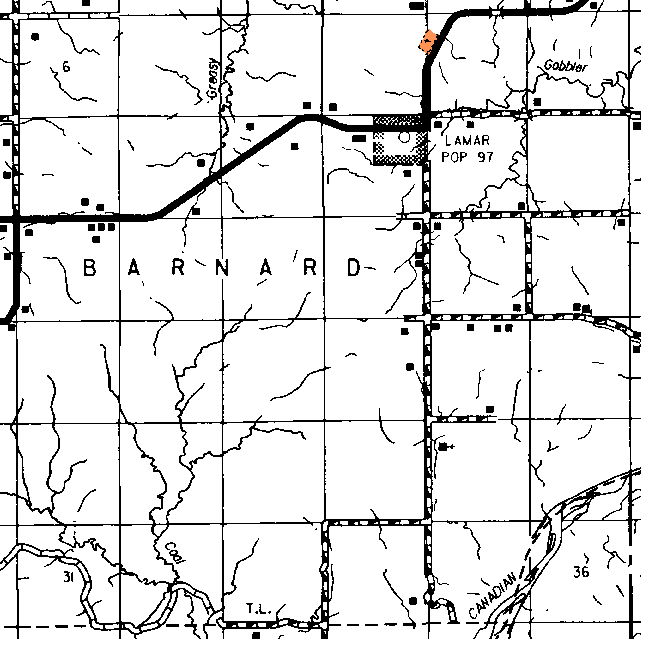
The cemetery shown here in Sections 2 & 3 is shown on the topographic map as triangular shaped and in Section 2 but is labeled Lamar.
| Cemetery | Sec | Latitude | Longitude | Quad | |
| Lamar Cemetery | Going East of Horns Corner (Intersection of Highways 75 And 270) take Highway 84, go 7.4 miles to the east end of the town of Lamar. Turn north .6 of a mile to cemetery marker on west side of the highway. | 2 | 350642N | 0960722W | Wetumka SE |
Click on cemetery name for more details from GNIS. Use Lat/Long and Quad name for consulting conventional maps or searching Topozone.
![]()
|
Page last updated
on
Tuesday, July 21, 2026
This site maintained by
Mel Owings
![]()