|
Pottawatomie County
Cemeteries |
|
|
Abrams Cemetary Bates Cemetery
Bethel Cemetery Black Cemetary Blackburn Chapel Cemetary Brooksville Cemetary Brown Cemetary Calvary Cemetary
Centerville Cemetary
Collins Cemetary Council Creek Cemetary Cummings Cemetary Dale Cemetary Dripping Springs Cemetary
Earlsboro Cemetary Fairview Cemetary Shawnee Fairview Cemetary Forest Hill Cemetary Friendship Cemetary Garden Grove Cemetary Giles Cemetary Highland Cemetary Hopewell Cemetary Jent Cemetary Johnson Cemetary Keokuk Cemetary Light Cemetary Lone Star Cemetary Lyons Cemetary Mars Hill Cemetary McLoud Cemetary Metcalf Cemetary Minneha Cemetary Moral Cemetary Neal Cemetary New Hope Cemetary Oak Grove Cemetary Oak Grove Cemetary Pleasant Valley Cemetary Prairie View Cemetary Prospect Cemetary Ray Cemetary Resthaven Cemetary Romulus Sacred Heart Cemetary Sacred Heart Abby Cemetary Sacred Heart Sisters Cemetary Sangster Family Cemetary St. Gregory's Cemetary St Johns Cemetary Tecumseh Cemetary Tribbey Cemetary Union Cemetary Violet Cemetary Vista Cemetary Wanette Cemetary
|
|
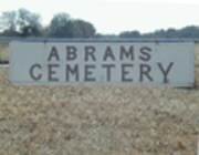 |
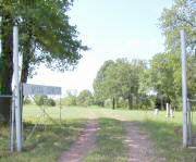
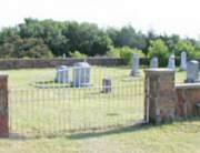
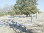
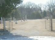
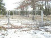
Abrams Cemetery is located north and east of McLoud. The easiest way to reach it is as follows: From I-40 northwest of Shawnee, take Hwy. 177 north about three and one half miles. Turn left and go west for one and one half miles. The cemetery is on the south side of the road. I have listed the graves by row starting from the west end of the cemetery with plots proceeding from north to south. Examples: R2-4 would be the fourth grave in from the north end of row 2. R1-3 would be the third grave in from the north end of the first row at the west end of the cemetery. This small cemetery has been vandalized and some stones turned over and too heavy for me to upright.
|
 |
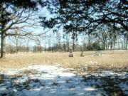
Avoca Cemetery is located about 4 miles south of Pearson (Hwy. 59) or 2 miles north of Hwy 39 and 1 mile west of Hwy 177, northwest of Asher. It sits on the south side of the gravel road. I have listed the graves by row starting from the west end of the cemetery with plots proceeding from north to south. Examples: R5-4 would be the fourth legible grave marker in from the north end of row 5. R1-3 would be the third legible marker in from the north end of the first row at the back of the cemetery. There are only a few graves on the east end of the cemetery. This results in my guessing at row numbers past row 18. Note: The land for this East end of the cemetery was donated to the town of Asher by Mr. James J Tooley.
|
 |
Bates Cemetery is located east of Asher and west of Konawa, just barely inside the Pottawatomie County line. From the intersection of Hwy. 177 and Hwy. 39, go east on Hwy. 39 for almost nine miles. When you see the Seminole County line, look to the left and you will see the cemetery enclosed in a stone wall. Note that this cemetery is a small one next to Hwy. 39 and just to the west of Violet Cemetery which is much larger. I have listed the graves by row starting from the east end of the cemetery with plots proceeding from north to south. Examples: R2-4 would be the fourth grave in from the north end of row 2. R1-3 would be the third grave in from the north end of the first row at the west end of the cemetery.
|
 |
Bethel Cemetery is located about five miles south of I-40 or three miles north of Hwy 9. Take Hwy. 102 south from I-40 for five miles to Hardesty Road. Go east on Hardesty Road for about one and one half miles. This cemetery is on the north side of Hardesty Road behind the church. I have listed the graves by row starting from the east end of the cemetery with plots proceeding from north to south. Examples: R5-4 would be the fourth grave in from the north end of row 5. R1-3 would be the third grave in from the north end of the first row at the east end of the cemetery.
|
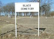 |
Black Cemetery is located east of Norman and north of Pink. On Hwy. 9 east of Norman, go about three and one half miles east past Harrah-Newalla Road or three miles west of Hwy. 102. Turn north off Hwy. 9 and go north for one mile. The cemetery is on the northwest corner of the intersection. I have listed the graves by row with plots proceeding from south to north. The first row begins on the east and higher numbered rows proceed to the west end of the cemetery. Examples: R3-4 would be the fourth grave in from the south end of the third row from the east fence. |
| Back to top of Pottawatomie County Cemetery List | |
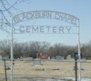 |
Blackburn Chapel Cemetery is located in Bethel Acres, behind the church. This is about three and one half miles west of Shawnee, OK, on Lake Road. From I-40, take Hwy. 102 south three miles. Turn left on Lake Road and go east for almost two and one half miles. The cemetery is on the south side of the highway. I have listed the graves by section and row with plots proceeding from north to south. Examples: N-R5-4 would be the fourth grave in from the north end of row 5 in the north section. S-R1-3 would be the third grave in on the first row of the south section. I have numbered row 1 at the west end of the cemetery and used progressively higher numbers as I moved toward the east end. Notice that on the northeast corner, rows are staggered. This resulted in my numbering a short row as N-R11 and trying to follow the stagger on the remaining ones. SW-R3-3 is located in the southwest corner of the cemetery, the third row and third grave.
|
 |
Brooksville Cemetery is located about 4 miles south of Tecumseh. From Hwy. 9, go south on Hwy. 177 until you reach the Brooksville sign on the west side of the highway. Go west for a mile and one half. Turn left at the large gas or propane plant on the left side of the road. Take this gravel road until it deadends (maybe two or three miles). Turn left (south) and proceed into Brooksville. The next street after the stop sign, turn right (west) on Broadway. At the blue water tower, turn left and proceed until you run into the cemetery on the left side of the road. I have listed the graves by row starting from the west end of the cemetery with plots proceeding from north to south. Examples: R5-4 would be the fourth legible grave marker in from the north end of row 5. R1-3 would be the third legible marker in from the north end of the first row at the back of the cemetery. Note: This is a very old cemetery with more graves without readable markers than those with. GPS location is 35.11.30 and 96.58.30.
|
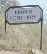 |
Brown Cemetery is located about three miles east of Pink, Pottawatomie County, OK, on Hwy 9. From I-40, take Hwy. 102 south about eight miles. The cemetery is about 1/2 mile west of Hwy 102 on Hwy 9 on the north side of the highway. I have listed the graves by section and row with plots proceeding from north to south. Examples: W-R5-4 would be the fourth grave in from the north end of row 5 in the west section. M-R1-3 would be the third grave in on the first row of the middle section. NE-R4-6 would be the sixth grave in on the fourth row of the northeast section. Caretaker: Joe Stansell, (405) 598-3249. I was told that the land for the cemetery was given to the town from the homestead of Dr. Thomas Clay Williamson, who is buried there.
|
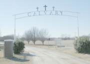 |
Calvary Cemetery is located on Highway 177 between Shawnee and I-40. This cemetery has several internal roads dividing it into sections. I have listed the graves within the various sections. Starting with Section A in the northeast corner with Sections B and C to the west of A. Section D starts back at the far east with Sections E, F and G going to the west of D. Next, Section H is back to the far east just south of Section D. Sections I, J and K proceed west from Section H. Section L is just to the south of Section K. Section M is in the far southeast corner of the cemetery. Within each section, I always number the rows from east to west and within each row I number the monuments from north to south. Example: Plot A-R5-4 would be the fourth grave from the north end of Row 5 of Section A. The circle with the large cross is at the southwest corner of my Section E, at the southeast corner of Section F, at the northwest corner of Section I and the northeast corner of Section J. Without a cemetery map, it may be difficult to locate a particular grave. |
 |
Centerville Cemetery is located northwest of Shawnee. From I-40, take Hwy. 177 north about one mile. The cemetery is on the east side of the road. I have listed the graves by row starting from the west end of the cemetery with plots proceeding from north to south. Examples: R2-4 would be the fourth grave in from the north end of row 2. R1-3 would be the third grave in from the north end of the first row at the west end of the cemetery. |
| Back to top of Pottawatomie County Cemetery List | |
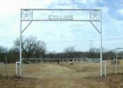 |
Collins Cemetery
is located east and south of the intersection of Hwys. 177 and Hwy 59 near St Louis. From the intersection of Hwys. 177 and 59, go east almost five miles. Turn south at Road N-S 346 and follow it one and one half miles. The cemetery is on the west side of the road. I have listed the graves by row starting from the east end (near the road) and proceeding west and with plots proceeding from north to south. Examples: R3-4 would be the fourth grave in from the north end of row 3. R9-3 would be the third grave in from the north end of the ninth row in from the road. Note that the rows are not straight. So you may have some trouble finding the graves I have listed.
|
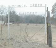 |
Council Creek Cemetery is located east of Norman and southwest of Pink. On Hwy. 9 east of Norman, go about three and one half miles east past Harrah-Newalla Road or three miles west of Hwy. 102. Turn south off Hwy. 9 onto a blacktop road and proceed through Pink for eight miles from Hwy. 9 to Hwy. 59B. Then go west for one mile and then four more miles south on a gravel road. The cemetery sits behind an old church on the west side of the road. I have listed the graves by row with plots proceeding from south to north. The first row begins on the east and higher numbered rows proceed to the west end of the cemetery. Examples: R3-4 would be the fourth grave in from the south end of the third row behind the old church. Note: This is a very small cemetery with many more graves than readable stones.
|
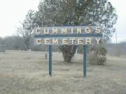 |
Cummings Cemetery is located about one and one half miles west of the intersection of Hwys. 9A and 59. This is a very large cemetery with several internal roads dividing it into sections. There are also parts of the cemetery on both the east and west sides of the road. I have listed the graves within the various sections. Starting with Section W1 in the northwest corner (near the sign) and working to the south, I have labeled the sections as W1, W2, W3 and W4. On the east side of the road, the rows run the entire width of the cemetery. Within each section, I always number the monuments from north to south.
|
 |
Dale Cemetery Exit I-40 onto Hwy 102 South. Make an immediate right turn at the first intersection and proceed west for about one half mile. The cemetery is on the north side of the road. I have cataloged this cemetery by blocks trying to follow the cemetery's original numbering system. Within numbered blocks, the burial plots run North to South. The oldest plots are in the Southwest corner. The newest are in the far East section. 300 series block numbers are not the same width as those directly to the south of them. If you have trouble finding a grave, contact me at
jwoodruff@mcloudteleco.com
|
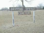 |
Dripping Springs Cemetery is located about one and 3/4 miles north of Maud on Hwy. 9A. At the Cemetery sign, turn west and follow the road to the cemetery. I have listed the graves by row starting from the east end (near the highway) and proceeding west and with plots proceeding from north to sourth. Examples: R3-4 would be the fourth grave in from the north end of row 3. R9-3 would be the third grave in from the north end of the ninth row in from the road. Note: There must ba close to 100 graves marked with cement crosses that have no names or dates.
|
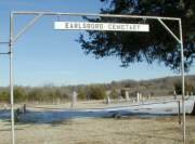 |
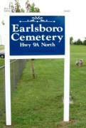
Earlsboro Cemetery is located about one mile north of Earlsboro on Hwy. 9A and less than one tenth of a mile east of Hwy. 9A. The cemetery is on the north side of the gravel road. I have listed the graves by row starting from the west end and proceeding east and with plots proceeding from south to north. Examples: R3-4 would be the fourth grave in from the south end of row 3. R9-3 would be the third grave in from the south end of the ninth row in from the road. For orientation, the gate is located between my Rows 14 and 15. Also, note that the rows are not straight.
|
 |
The Earlsboro Highway 9A North Cemetery (sometimes called New Hope) is located almost two miles north of Earlsboro on Hwy. 9A. The cemetery is on the east side of the road. I have listed the graves by row starting from the west end (near the road) and proceeding east and with plots proceeding from north to south. Examples: R3-4 would be the fourth grave in from the north end of row 3. R9-3 would be the third grave in from the north end of the ninth row in from the road. Note that the rows are not straight. Also, rows 24, 25, and 26 are short rows near the south end and between complete rows 23 and 27. So you may have some trouble finding the graves I have listed.
|
 |
Fairview Shawnee Cemetery is located on Harrison Street near the intersection of Harrison and Independence. You cannot enter from Harrison Street but must go east on Independence Ave. for one block and turn right (south) on Center Street and enter the backside of the cemetery from Center Street. This is a very large cemetery with several internal roads dividing it into sections. I have listed the graves within the various blocks. Starting with Block 1 near the southeast corner and ending with Block 19 on the northeast corner, I have labeled the blocks as they are labeled on the cemetery's metal signs. Within each block, I always number the monuments within the row from north to south and start with row number 1 in the northwest corner of that block. Example: B1-R5-4 would be the fourth grave from the north end of Row 5 of Block 1. B7-R6-6 would be the sixth marker from the north end of Row 6 of Block 7. Block 18 currently does not have any graves. This is a large cemetery and you may need help in finding a particular grave. There is an office at the northeast end of the cemetery that should be able to help. Blocks 5 and 6 are each separated into two blocks by roads. Blocks 5A and 6A are on the west end and 5B and 6B are to the east of the road. Block 14 is also separated into two blocks by a road. 14S is to the south of the road and 14N is to the north of it. On the east side of Center Street, are Blocks 1NE (northeast), 1SE (southeast) and 2E (east). |
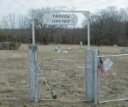 |
Fairview Cemetery
is located about five and one half miles south of Hwy. 9, near Harjo. From the intersection of Hwys. 9 and 9A. go south for about five miles. At the Cemetery sign on Hwy 9A, turn west and go one mile. Then go south for one half mile. Then go west for one third mile. The cemetery is on the south side of the road. I have listed the graves by row starting from the west end (near the gate) and proceeding east and with plots running from north to south. Examples: R3-4 would be the fourth grave in from the north end of row 3. R9-3 would be the third grave in from the north end of the ninth row in from the gate.
|
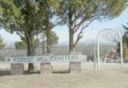 |
Forest Hill Cemetery was established in 1892 and is located east and south of Tecumseh. Take Hwy. 9 east through Tecumseh for about one and one half miles past Hwy. 177 to Skaggs City Road. Go south about two and one quarter miles. The cemetery is on the east side of Skaggs City Road. The first two rows run the entire width of the cemetery. The remainder of the cemetery is separated into north and south sections by a road. I have listed the graves by row starting from the west end of each section (north & south) and proceeding east and with plots proceeding from north to south. On the north side of the interior road, I begin the row 3 at the north-south interior road and work back to the east. I do the same thing for the South Section. I use the same row numbers as those that are numbered on cement blocks next to the east-west interior road. Examples: N-R5-4 would be the fourth grave in from the north end of Row 5 of the North Section. S-R7-3 would be the third grave in from the north end of the seventh row of the South Section of the cemetery. |
| Back to top of Pottawatomie County Cemetary List | |
 |
Friendship Cemetery is near Tribbey. Proceed south on Hwy. 102 ten miles from Hwy. 9 or two miles from Hwy. 59B. Just coming into Tribbey, turn east at the sign for "JJ Ranch and Arena." Go east and southeast on this crooked, gravel and dirt road for 2.3 miles. At the "Cemetery" sign, turn right and go almost one half mile. The cemetery is on the right (west) side of the road. I have started numbering the rows at the road (east end of the cemetery). Within the rows, I number the plots from north to south. Example: R2-5 would be fifth readable tombstone in from the north end of the second row in from the east fence. Note: This is a very small cemetery with many more graves than readable stones.
|
 |
Garden Grove Cemetery is located northeast of Shawnee. From I-40, take Hwy. 18 north about three and one half miles to Hwy EW-109 (Moccasin Trail Road). Go east on EW-109 for eight miles. Or from Seminole, take Hwy. 99 north to EW-109 and go west for six miles. Then go south one mile. The cemetery is on the north side and the Garden Grove Missionary Baptist Church is on south side of the road. I have listed the graves in sections, with the East Section being on the east side of the cemetery entrance gate and the West Section beginning at the flagpole and proceeding to the west boundary. The row numbers begin next to the gate and proceed to the east end of the cemetery or at the flagpole to the west end. Within the rows, the plot numbers proceed from south to north. Examples: E-R2-4 would be the fourth grave in from the south end of row 2 of the East Section. W-R7-3 would be the third grave in from the south end of the seventh row of the West side of the cemetery. Note: Rows 13 and 14 of the East Section are short rows beginning near the northeast corner and Row 1 of the West Section is a short row that begins just north of the flagpole.
|
 |
Giles Cemetery is located north of Seminole. From I-40, take Hwy. 99 north about three and one half miles to Hwy EW-109 (Moccasin Trail Road). Go east on EW-109 for two miles. The cemetery is on the north side of the road. I have listed the graves by rows beginning in the east end of the cemetery and proceeding to the west boundary. Within the rows, the plot numbers proceed from north to south. Examples: R2-4 would be the fourth grave in from the north end of second row in from the east end of the cemetery. R7-3 would be the third grave in from the north end of the seventh row.
|
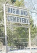 |
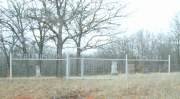
Highland Cemetery is located about three miles east and three miles south of Pink, Pottawatomie County, OK, on Hwy 102. From I-40, take Hwy. 102 south about 11 miles. The cemetery is about 3 miles south of Hwy 9 on Hwy 102 on the west side of the highway. I have listed the graves by row starting from the west end of the cemetery with plots proceeding from north to south. Examples: R5-4 would be the fourth grave in from the north end of row 5. R1-3 would be the third grave in from the north end of the first row at the back of the cemetery.
|
 |
Hopewell Cemetery is located about five miles south of I-40 or three miles north of Hwy. 9. Take Hwy. 102 south from I-40 for five miles to Hardesty Road. Go east on Hardesty Road for about one and one half miles. This cemetery is on the south side of Hardesty Road across the street from the church. I have listed the graves by row starting from the west end of the cemetery with plots proceeding from north to south. Examples: R5-4 would be the fourth grave in from the north end of row 5. R1-3 would be the third grave in from the north end of the first row at the west end of the cemetery. |
| Back to top of Pottawatomie County Cemetary List | |
 |
Jent Cemetery is located north and east of McLoud. From the four-way stop sign in McLoud, take Hwy. 102 north for one half mile to the first intersection. Turn right and go east for two miles. Turn left and proceed north for about one half mile. The cemetery is on the east side of the road. I have listed the graves by row starting from the west end of the cemetery with plots proceeding from north to south. Examples: R2-4 would be the fourth grave in from the north end of row 2. R1-3 would be the third grave in from the north end of the first row at the west end of the cemetery.
|
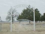 |
Johnson Cemetery is located northeast of Shawnee. From I-40, take Hwy. 18 north about one and one half miles to Hwy EW-111. Go east on EW-111 for almost four miles. The cemetery is on the south side of the road. I have listed the graves in sections, with the East Section being on the east side of the cemetery entrance road and the West Section being on the west side of that road. The row numbers begin next to the road and proceed to the east end of the cemetery or across the road to the west end. Within the rows, the plot numbers proceed from north to south. Examples: E-R2-4 would be the fourth grave in from the north end of row 2 of the East Section. W-R7-3 would be the third grave in from the north end of the seventh row of the West side of the cemetery. Note: Row 7 of the East Section is very crooked and Row 3 of the West Section is a short row that begins near the south end.\\
|
 |
Keokuk Cemetery is located north of Seminole, OK. From I-40, take Hwy. 99 north about 1.4 miles, just across the North Canadian River. Turn right on EW-111. Proceed east about 1.3 miles. Turn left and go north one half mile. Turn right and go about 2/10 mile to a private gate. Open gate, drive through, close gate behind you. Proceed along trail, through pasture about 1/3 mile to cemetery. I have listed the graves by section and row with plots proceeding from north to south. Examples: N-R5-4 would be the fourth grave in from the north end of row 5 in the north section. S-R1-3 would be the third grave in on the first row of the south section. I have numbered row 1 at the west end of the cemetery and used progressively higher numbers as I moved toward the east end. Note: This is an old cemetery with many graves without stones and many unreadable stones. Also, it has been vandalized with many stones over-turned and some broken. |
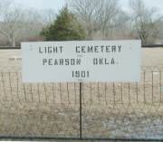 |
Light Cemetery is located in Pearson. From the intersection of Hwys. 177 and 59, go east almost one mile. The cemetery is on the north side of Hwy. 59. I have listed the graves by row starting from the west end of the cemetery and proceeding east and with plots proceeding from south to north. Examples: R2-4 would be the fourth grave in from the south end of row 2.
|
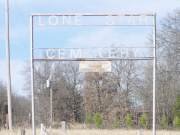 |
Lone Star Cemetery is located about 6 miles southwest of Tecumseh. From Hwy. 9, go south on Hwy. 177 until you reach the Brooksville sign on the west side of the highway. Go west for a mile and one half. Turn left at the large gas or propane plant on the left side of the road. Take this gravel road until it dead ends (maybe two or three miles). Turn left (south) and proceed into Brooksville. Continue on south through Brooksvile. Turn right (west) on Rattlesnake Hill Rd and go two miles. The cemetery is on the north side of the road.. I have listed the graves by row starting from the west end of the cemetery with plots proceeding from north to south. Examples: R5-4 would be the fourth legible grave marker in from the north end of row 5. Note: This is a very old cemetery with more graves without readable markers than those with.
|
| Back to top of Pottawatomie County Cemetary List | |
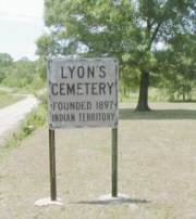 |
Lyons Cemetery is located east of Asher. From the intersection of Hwy. 39 and EW-348, go south on EW-348 for one mile turn right and go west about 1/2 mile. The cemetery is on the north side of the road. I have listed the graves by row starting from the east end of the cemetery with plots proceeding from north to south. Examples: R2-4 would be the fourth grave in from the north end of row 2. R1-3 would be the third grave in from the north end of the first row at the east end of the cemetery.
|
 |
Martin Hill Cemetery is located west and south of the intersection of Hwy 102 and Hwy 39 near Wanette. From the intersection of Hwys. 102 and 39, go west five miles. Turn south and follow the gravel road one mile south and one half mile west. The cemetery is on the south side of the road. I have listed the graves by row starting from the west end of the cemetery with plots proceeding from north to south. Examples: R4-4 would be the fourth grave in from the north end of row 4. R6-3 would be the third grave in from the north end of the sixth row from the west end of the cemetery. Note that the rows are not straight. So you may have some trouble finding the graves I have listed. |
 |
Mars Hill Cemetery is located east of Norman and southwest of Pink. On Hwy. 9 east of Norman, go about three and one half miles east past Harrah-Newalla Road. Turn south off Hwy. 9 onto a blacktop road and proceed through Pink for seven miles from Hwy. 9. Then go west on a gravel road for one mile. The cemetery sits beside an old church on the north side of the road. I have listed the graves by section and row with plots proceeding from north to south. Examples: N-R5-4 would be the fourth grave in from the north end of row 5 in the north section. S-R1-3 would be the third grave in on the first row of the south section. I have numbered row 1 at the west end of the cemetery and used progressively higher numbers as I moved toward the east end. My numbers match those placed in the ground at the end of the rows nearest the cemetery's internal center road. |
 |
The cemetery is located as follows: From I-40, take Hwy 102 North to McLoud -- 3.4 miles. Turn left (East) on Broadway, also SE 29th St., and go two miles to Fishmarket Road. Go north on Fishmarket Road about one half mile. The cemetery is on the left. The names are listed by North, Middle or South section, then Row and within rows the low number is at the north end of the row. Example: N-R1-1 is North Section, Row 1 and the first grave at the north end of the row. M-R5-6 is the sixth grave from the north end of Row 5 of the Middle Section.
|
 |
Metcalf Cemetery is located west and north of the intersection of Hwy 102 and Hwy 39 near Wanette. From the intersection of Hwys. 102 and 39, go west six miles. Turn north and follow the gravel and dirt road three miles north until it deadends. Turn west until it deadends, about one eight of a mile. The cemetery is on the south side of the road. I have listed the graves by row starting from the west end of the cemetery with plots proceeding from north to south. Examples: R2-4 would be the fourth grave in from the north end of row 2. R7-3 would be the third grave in from the north end of the seventh row from the west end of the cemetery.
|
 |
Minneha Cemetery is located about three fourths of a mile north of I-40. From the McLoud Exit of I-40, take Hwy. 102 north for about one half mile to the first intersection. Take Parkwood Road west for one mile. Turn and proceed north on Arena Road for about three tenths of a mile. The cemetery is on the east side of the road just to the north side of the Minneha Freewill Baptist Church. I have listed the graves by row starting from the west end of the cemetery with plots proceeding from north to south. Examples: R5-4 would be the fourth grave in from the north end of row 5. R1-3 would be the third grave in from the north end of the first row at the west end of the cemetery. |
| Back to top of Pottawatomie County Cemetary List | |
 |
Moral Cemetery, founded in 1895, is located just west of Hwy 102, about three miles south of Tribbey or 5.3 miles south of Hwy 59B or 6 miles north of Hwy 39. The cemetery is on the south side of the road. I have listed the graves by row starting from the east end of the cemetery with plots proceeding from north to south. Examples: R4-4 would be the fourth grave in from the north end of row 4. R7-3 would be the third grave in from the north end of the seventh row from the northeast end of the cemetery. Note that the rows are not straight. So you may have some trouble finding the graves I have listed.
|
 |
Neal Cemetery is located about six miles east of Shawnee, OK. From Shawnee, take Hwy 3E east to Hwy 9A. Go one mile east from the intersection of Hwys. 3E and 9A. Then go south one half mile. The cemetery is on the east side of the road. I have listed the graves by row beginning at the west end of the cemetery and within the rows plots proceed from north to south. Example: N-R5-4 would be the fourth grave in from the north end of the fifth row from the road and the North side of the cemetery. S-R8-6 would be the sixth grave marker in from the north end of the eight row in from the road and in the South side of the cemetery. North and South sides are separated by and internal road. I have received Caretaker's data for burials that have no readable stones or markers. These I have listed in the manner provided--Block, Lot and Space numbers. B2-L10-S2 would be Block 2, Lot 10, Space 2. |
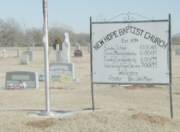 |
New Hope Cemetery, founded in 1894, is located about three miles west and one mile north of downtown Tecumseh, OK. From Tecumseh, take Hwy 9 to Coker Road. Go north on Coker Road one mile to New Hope Road. Go west on New Hope Road about one half mile. The cemetery is on the north side of the road at the New Hope Baptist Church. I have listed the graves by row beginning at the east end of the cemetery and within the rows plots proceed from north to south. Examples: R5-4 would be the fourth grave in from the north end of the fifth row from the east end. R1-3 would be the third grave in on the first row.
|
 |
Oak Grove Cemetery is located east and south of the intersection of Hwys. 177 and Hwy 59 near Pearson. From the intersection of Hwys. 177 and 59, go east three quarters of a mile. Turn south at the first paved road and follow it one mile. At the first intersection, go east about one third of a mile. The cemetery is on the south side of the road with an old church separating the east and west sections. I have listed the graves by row starting from the west end of the east section and proceeding east and with plots proceeding from north to south. On the west side of the church, I begin the first row at the east fence and work back to the west. Examples: E-R4-4 would be the fourth grave in from the north end of row 4 of the East Section. W-R2-3 would be the third grave in from the north end of the second row of the West Section of the cemetery. Note that the rows are not straight. So you may have some trouble finding the graves I have listed. |
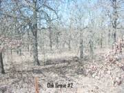 |
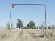
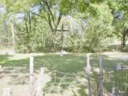
Oak Grove #2 Cemetery is south of Bethel Acres. From Hwy. 9, go south on Bethel Road for two miles. Turn left (east) and go 1.2 miles. The cemetery is on the north side of the road. It is very old and very difficult to see but is surrounded by a barbed wire fence. Only three readable stones remain. |
| Back to top of Pottawatomie County Cemetary List | |
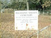 |
Pleasant Valley Cemetery is located south and east of Tecumseh. From the intersection of Hwy. 9 and 177, go south about eight miles. Turn east at the Shamrock Gas Station. Go east 3/10 of a mile. Turn right and go 3/10 mile. Turn left on Fairview Rd. and proceed northeast for 1.8 miles. Turn right and proceed south for about 1.2 miles. Just after the road makes a sharp left, you will turn right. Go south for one half mile and the cemetery will be on the west side back a ways off the road. I have listed the graves by row starting from the east end (near the road) and proceeding west and with plots proceeding from north to sourth. Examples: R3-4 would be the fourth grave in from the north end of row 3. R9-3 would be the third grave in from the north end of the ninth row in from the road. Note: This cemetery has been vandalized and some stones repaired but many are still turned over and several broken.
|
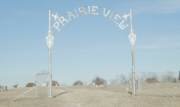 |
Prairie View Cemetery, founded in 1903, is located about two miles east of Macomb or two miles west of Hwy 177 eight miles south of Tecumseh, OK. From Tecumseh, take Hwy 177 south to Hwy 59. Go west on Hwy 59 two miles. The cemetery is on the north side of the road. I have listed the graves by row beginning at the west end of the cemetery and within the rows plots proceed from north to south. Example: R5-4 would be the fourth grave in from the north end of the fifth row from the east end. The first two rows are short rows in the far northwest corner of the cemetery. Also, some of the first eight rows are not straight, so you may have trouble finding the graves I have listed.
|
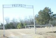 |
Prospect Cemetery is located one mile south of the intersection of Hwys. 102 and 59B and then one mile west of Hwy. 102 down a gravel road. The cemetery is on the south side of the road. I have listed the graves by row starting from the east end of the cemetery with plots proceeding from north to south. Examples: R4-4 would be the fourth grave in from the north end of row 4. R7-3 would be the third grave in from the north end of the seventh row from the northeast end of the cemetery. Note that there are at least 50 steel white crosses that have no names on them. |
 |
Ray Cemetery is located about four and one half miles south of I-40 or four miles north of Hwy. 9. Take Harrah-Newalla Road south from I-40 to SE 149th or Clear Pond Road. Go east on SE 149th for three miles. This cemetery is at the intersection of SE 149th and Walker Road. I have listed the graves by row starting from the east end of the cemetery with plots proceeding from north to south. Examples: R5-4 would be the fourth grave in from the north end of row 5. R1-3 would be the third grave in from the north end of the first row at the east end of the cemetery.
|
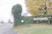 |
Resthaven Cemetary |
| Back to top of Pottawatomie County Cemetary List | |
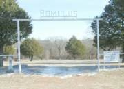 |
Romulus Cemetery is located two miles south of the intersection of Hwys. 177 and Hwy 59B and three miles north of Hwy 59. The cemetery is on the east side of Hwy. 177. I have listed the graves by row starting from the west end of each section (north & south) and proceeding east and with plots proceeding from north to south. On the north side of the main gate, I begin the first row at the west fence and work back to the east. I do the same thing for the South Section, to the south of the main gate. Examples: N-R4-4 would be the fourth grave in from the north end of Row 4 of the North Section. S-R2-3 would be the third grave in from the north end of the second Row 2 of the South Section of the cemetery.
|
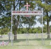 |
Sacred Heart Cemetery is located east of Asher and west of Konawa. From the intersection of Hwy. 177 and Hwy. 39, go east on Hwy. 39 for seven miles. At NS-348, turn left and go north almost one mile. Turn left (west) and the cemetery is on the south side of the road and you enter it next to the church. I have listed the graves by row starting from the west end of the cemetery with plots proceeding from north to south. Examples: R2-4 would be the fourth grave in from the north end of row 2. R1-3 would be the third grave in from the north end of the first row at the west end of the cemetery. For more information, contact Sacred Heart Cemetery, RT. 2
Box 105 Konawa, OK 74849 |
 |
Sacred Heart Abbey Cemetery is located east of Asher and west of Konawa. From the intersection of Hwy. 177 and Hwy. 39, go east on Hwy. 39 for seven miles. At NS-348, turn left and go north almost one mile. Turn left and proceed west about 1/2 mile (on past the church) until you come to a gate and the Sacred Heart Mission sign. Proceed through the gate to the top of the hill. Turn left and go maybe 200 yards. The cemetery is on your left. I have listed the graves by row starting from the west end of the cemetery with plots proceeding from north to south. Examples: R2-4 would be the fourth grave in from the north end of row 2. R1-3 would be the third grave in from the north end of the first row at the west end of the cemetery. Note: Many of the name plates are missing from the crosses and could not be included here. |
 |
Sacred Heart Sisters Cemetery is located east of Asher and west of Konawa. From the intersection of Hwy. 177 and Hwy. 39, go east on Hwy. 39 for seven miles. At NS-348, turn left and go north almost one mile. Turn left and proceed west about 1/2 mile (on past the church) until you come to a gate and the Sacred Heart Mission sign. Proceed through the gate to the top of the hill. Turn left and go maybe 400 yards--on past the Abbey Cemetery. The cemetery is on your left. I have listed the graves by row starting from the west end of the cemetery with plots proceeding from north to south. Examples: R2-4 would be the fourth grave in from the north end of row 2. R1-3 would be the third grave in from the north end of the first row at the west end of the cemetery. Note: Many of the name plates are missing from the crosses and could not be included here. |
 |
Sangster Family Cemetery is located east and south of the intersection of Hwys. 9 and 9A, south of Earlsboro. From the intersection of Hwys. 9 and 9A, go south two miles. Turn left on E-W 123 and go east about one and one fourth miles. The cemetery is on the south side of the road with a chainlink fence around it and sitting in a large pasture. There is only one row of headstone. |
| Back to top of Pottawatomie County Cemetary List | |
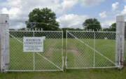
St Gregory's No Picture |
St. Gregory's Cemetery is located west and north of the intersection of Hwy 102 and Hwy 39 near Wanette. From the intersection of Hwys. 102 and 39, go west six miles. Turn north and follow the gravel road one mile north. Turn right and go about one quarter mile east. The cemetery is on the south side of the road. I have listed the graves by row starting from the west end of the cemetery with plots proceeding from north to south. Examples: R2-4 would be the fourth grave in from the north end of row 2. There are only two rows with markers, plus one grave in the far southeast corner which I have labeled as Row 6. |
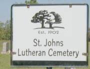 |
St.
John's Lutheran Cemetery is located as follows: From I-40, take Hwy 102 North to McLoud -- 3.4 miles. Turn left (East) on Broadway, also SE 29th St., and go one mile to Arena Road. Go south on Arena Road about one half mile. The cemetery is on the right (west) side of the road. This is a German-Lutheran Cemetery. The names are listed by row beginning at the east end, next to the road. Within rows the low number is at the north end of the row. Example: R1-1 is Row 1 and the first grave at the north end of the row. R5-6 is the sixth grave from the north end of Row 5 Section. |
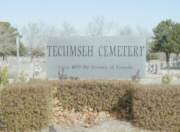 |
Tecumseh Mission Cemetery is located between Shawnee and Tecumseh, on the west side Hwy 18. This is a very large cemetery with several internal roads dividing it into Additions and Blocks within each addition. I have listed the graves within the various additions and blocks which are marked by cement posts. I have labeled the additions and blocks as follows: A1B1-R1-4 is the fourth marker in from the north end of row one of Addition 1, Block 1. A4B3-R5-3 is the third marker in the fifth row of Addition 4, Block 3. Within each section, I always number the monuments from north to south and the rows are always numbered starting at the east end of the block and progressing west. There is an office on-site that can also help you find a particular grave. Phone (405) 273-4992 |
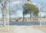 |
Tribbey Cemetery is located on Hwy 102, about one mile south of Tribbey or 3.3 miles south of Hwy 59B or 11.2 miles south of Hwy 9 or 16 miles south of I-40. The cemetery is on the east side of the road. I have listed the graves by row starting from the west end of the cemetery with plots proceeding from north to south. Examples: R4-4 would be the fourth grave in from the north end of row 4. R7-3 would be the third grave in from the north end of the seventh row from the northwest end of the cemetery. Note that the rows are not straight and some short rows (only one or two graves) have been placed between full rows at the south end of the cemetery. Also, rows number 1 and 2 are in the far northwest corner and do not extend all the way across the cemetery.
|
 |
Union Cemetery is located east and south of the intersection of Hwys. 9 and 9A, south of Earlsboro. From the intersection of Hwys. 9 and 9A, go east one mile. Turn south on N-S 348 and follow the gravel road two miles. Turn at E-W 123 and go east about one half of a mile. The cemetery is on the south side of the road and I divided it into east and west sections with the gate separating them. I have listed the graves by row starting from the west end of each section and proceeding east and with plots proceeding from north to south. On the west side of the gate, I begin the first row at the west fence and work toward the gate (east). On the east side of the gate, I begin the first row at the gate and proceed to the east fence Examples: E-R4-4 would be the fourth grave in from the north end of row 4 of the East Section. W-R2-3 would be the third grave in from the north end of the second row of the West Section of the cemetery. Note that the rows are not straight. So you may have some trouble finding the graves I have listed. It is a small cemetery, so you should find them. |
| Back to top of Pottawatomie County Cemetary List | |
 |
Violet Cemetery
is located east of Asher and west of Konawa, just barely inside the Pottawatomie County line. From the intersection of Hwy. 177 and Hwy. 39, go east on Hwy. 39 for almost nine miles. When you see the Seminole County line, look to the left and you will see the cemetery. Note that this cemetery is bordered by Hwy. 39, EW-141 and NS-350. Do not confuse it with the Konawa Cemetery which is a little farther off of HW. 39. Also, the graves closest to Hwy. 39 that are inside a smaller rock-walled section are listed in the "Bates Cemetery"--not this Violet Cemetery. I have listed the graves by row starting from the east end of the cemetery with plots proceeding from north to south. Examples: R2-4 would be the fourth grave in from the north end of row 2. R1-3 would be the third grave in from the north end of the first row at the west end of the cemetery. |
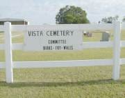 |
Vista Cemetery is located east of Asher. From the intersection of Hwy. 177 and Hwy. 39, go east on Hwy. 39 for five miles. At the "Cemetery" sign, turn right and go south one mile. Then go west about 1/4 mile. The cemetery is on the north side of the road. I have listed the graves by row starting from the west end of the cemetery with plots proceeding from north to south. Examples: R2-4 would be the fourth grave in from the north end of row 2. R1-3 would be the third grave in from the north end of the first row at the west end of the cemetery. For more information, contact Vista Cemetery, Box 102, Konawa, OK 74849. |
 |
Wanette Cemetery is located one mile south of Hwy 39 and one mile east of Hwy 102. This is a very large cemetery with several internal roads dividing it into sections. I have listed the graves within the various sections. Starting with Section A in the far southeast corner and working to the north, I have labeled the sections as A, B, C, D and E. Within each section, I always number the monuments from north to south. Example: Plot A-R5-4 would be the fourth grave from the north end of Row 5 of Section A. Section E extends on past the outhouse. Section F begins at the main gate on the west side of the gate road and extends the width of both Sections A and B. Section G follows to the immediate north of Section F. Section H is the small section to the south of the outhouse. Section I is to the west of Section H. The far west end has two long rows extending almost the length of the cemetery. I labeled this as Section J. These are very long rows extending from about even with the outhouse to the south cemetery fence. Example: J-R1-40 would be the 40th grave marker in from the north end of Row 1 of Section J. |
| Back to top of Pottawatomie County Cemetary List | |