|
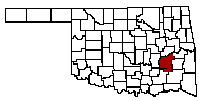
Pittsburg County |
|
 |
 |
 |
 |
 |
 |
01 Local Location Information/Histories - Location information
Lake Eufaula Guide Map - Numbers in the Column: "Source of Name /Location" relate to this map
Source
Of
Name
Location
Dates
Of
Post
Office
GPS Location
Indian
Territory
Choctaw
Nation
Moshulatubbee District
Tobucksy
County
State of
Oklahoma
Pittsburg
County
Adamson
TBD
Alderson
TBD
Alta Vista
Arch
TBD
Archibald
TBD
Arrowhead
Estates
169 -
Arrowhead
Shores
167 -
Arrowhead State Park
Arpelar
TBD
Ashland
TBD
Bache
TBD
Baker
3 miles west of McAlester, OK
Small community, no longer in
Existence
Bald
Mountains
Balwin
Acres
Blanco
10 miles northeast of Kiowa, OK
On Hwy 63. A mining town
Named for Ramon Blanco, Y
Erenas, Governor General of
Cuba, 1897-98
August 31, 1901 to date
Blackburn's Station
6 miles south of Blanco, OK
A stage stop on the Butter-
Field Overland Mail route
To California, 1858-61, Named
For Casper B. Blackburn, Local
Trader.
Blocker
15 miles northeast of McAlester,
OK on Hwy 31. Named for Eads
Blocker, local coal dealer
April 26, 1905 to date
Bond
2 ½ Miles southwest of Craig
Along railroad. No longer in
Existence.
Bower
Brewerville
2 miles south of Savanna, OK
A small mining community.
No longer in existence.
Buck
2 miles east of Krebs, OK on
Hwy 270. A small mining September 31, 1907
Camp. Also known as Buck
Station. No longer in Existence
January 19, 1900 to
Buckluckay
Buffalo
Station
7 miles south of Haileyville,
OK. Established in 1867, an
Important stage stop on the
Post-Civil War mail routes
Crossing southeastern OK
Bugtussle
9 miles northeast of McAlester
OK, often known as Flowery
Mound. The meaning is a
Colloquialism meaning a rustic
Settlement or backwoods area.
The boyhood home of Carl Albert
Speaker of the House of Represent-
Atives of the U.S. Congress.
Busby
1 mile east of North McAlester, OK
No longer in existence.
Bush
Small mining community 1 mile
Northeast of Alderson. No longer
In existence.
Cabiness (Cabaniss)
15 miles northwest of Mcalester,
OK. Named for Thomas B.
Cabaniss, a member of the
Dawes Commission
April 18, 1903 to August 15, 1922
Caldwell
Small community along Railroad
Midway between Blanco and
Bond. No Longer in existence.
Canadian
10 miles southwest of Eufaula, Ok
On Hwy 69. Nearby was Canadian
Depot, and important supply point
During the Civil War. Formly
South Canadian-changed Dec. 11, 1899.
Current
Canadian
Shores
177 -
Carbon
7 miles east of McAlester, OK
Formerly known as Cherry- vale. Railroad name was
Simpson Station. It took its
Name from surrounding
Coal fields.
February 20, 1899 to November 30, 1933
Carlton
Landing
Celestine
5 miles northeast of Ashland, OK
November 12, 1896 to
March 31, 1915
Chambers
5 miles south of McAlester, OK
On Hwy 69. Located at the site
Of Perryville, and important
Settlement prior to the Civil
War. It was named for T. H.
Chambers, Coal mine operator.
January 26, 1904 to November 15, 1910
Cherryvale
7 miles east of McAlester, OK
See Carbon
Choate
Prairie
(Choate)
3 miles west of Indianola, OK
Named for George W. Choate,
Sheriff of Tobucksy County,
Choctaw Nation.
November 6, 1894 to May 31, 1904
Coleman
3 miles west of Haileyville, OK
Changed to Craig. Town first
Named for H. L. Coleman,
Townsite owner.
April 2, 1903 to December 7, 1905
Counts
11 ½ miles south of Hartshorne,
OK. A mining camp. No longer
In existence.
Craig
3 miles west of Hartshorne, OK
Named for William Craig. Local
Rancher. See Coleman.
December 7, 1905 to March 31, 1919
Crowder
Darcia
6 miles northwest of McAlester,
OK. Named for John Darcia of
Chicago, Ill Rancher
February 5, 1907 to November 28, 1909
Daisy
Dow
11 miles southeast of McAlester,
OK on Hwy 270. Named for
Andrew Dow, coal Producer.
December 7, 1898 to February 28, 1964
Dwight
3 miles northeast of Hartshorne,
OK on Hwy 270, and located at
Jones Academy. Named for
Simon T. Dwight, prominent
Choctaw.
October 4, 1895 to February 28, 1913
Edwards
3 miles east of Kiowa, OK.
On Hwy 63. Presently known
As Pittsburg. Formerly Cowper.
Named for J. R. Edwards, coal
Operator.
September 3, 1903 name Changed to Pittsburg August 27, 1909 to date
Featherston
7 miles west of Quinton, Ok
On Hwy 31. Named for Lucius
C. Featherston, early-day rancher.
June 23, 1892 to November 29, 1957
Flowery Mound
9 miles northeast of McAlester, OK
See Bugtussle.
Garner
5 miles west of Indianola, OK.
Formerly Thurman changed
To Garner. Named for Edward
L. Garner, first postmaster
July 1, 1902 to November 30, 1906
Givins
Mining community between
Krebs & Buck
Haileyville
14 miles southeast of McAlester,
OK on Hwy 270. Named for
Dr. Daniel M. Hailey, prominent
Resident of the Choctaw Nation
April 20, 1901 to date
Halleman
10 miles south of McAlester, OK
No longer in existence.
July 13, 1898 to March 31, 1904
Hartshorne
15 miles southeast of McAlester,
OK on Hwy 270. Named for
Dr. Charles Hartshorne, railroad
Official.
March 5, 1890 to date
Hay Ranch
1 ½ mile northeast of Pittsburg, OK
A small community, no longer in
Existence.
Haywood
11 miles southwest of McAlester,
OK On Hwy 31. The railroad
Name was Barnett. Named for
Bill Haywood, prominent Socialist.
September 20, 1904 to date
Heron
In northern Pittsburg County,
Adjoining the Canadian River.
Named for the heron species
Of bird. No longer in existence.
January 15, 1910 to September 30, 1910
Hickman
6 miles northeast of Stuart, OK.
Named for Eugene A. Hickman,
First postmaster. No longer in
Existence.
May 22, 1914 to November 30, 1914
Holiday Hills
174 -
Indianola
7 miles west of Canadian, OK
On Hwy 113. The name was
coined from the word Indian
and the Choctaw word Olah
meaning "this side of".
January 16, 1891 to date
Johnsville
1 mile southwest of Savanna, OK
A small town no longer in
Existence.
Jones
Academy
3 miles northeast of Hartshorne,
OK on Hwy 270. An Indian boys
School established in 1891 by the
Choctaw Nation. Named for
Wilson N. Jones, principal chief
Of the Choctaw Nation. Post Office
Was named Dwight.
Juanita
15 miles north of McAlester, OK.
Named for Juanita Harlan Crowder
Wife of Dr. W. E. Crowder early day
Physician. Named changed to
Crowder, June 4, 1904.
March 21, 1902 to date
Kiowa
17 miles south of McAlester, OK
On Hwy 69. Named for nearby
Kiowa Hill.
May 6, 1881 to date
Klondyke
Mining community 1 mile north-
West of Alderson.
Krebs
3 miles east of McAlester, OK on
Hwy 270/31. A mining town
Named for Judge Edmond F. Krebs,
Prominent Choctaw.
February 10, 1886 to date
Lake
Eufaula
Estates
168 -
Lodge
Point
North
144
Lodge
Point
South
146
Longtown
Massey
6 miles southeast of Crowder,
Named for W. W. Massey
Prominent Choctaw.
August 17, 1900 to May 31, 1918
McAlester
County seat of Pittsburg. Formerly South McAlester. Named for John J. McAlester Prominent merchant and Coal producer.
February 5, 1890, name Changed from South McAlester May 10, 1907. First
post office located 2 miles south of town site.
Spelling of name was
"McAlister" from March 31,
1873 to November 12, 1885.
McBees
Mine community 2 miles
Northwest of Alderson, OK.
Manning
Mine community 1 ½ miles
East of Adamson.
North
McAlester
Current location of McAlester; Name changed to distinguish Town from South McAlester 2 miles south on railroad.
Name changed from earlier spelling, "McAlister" on May 11, 1907; discontinued, June 30, 1909.
Perryville
5 miles southwest of McAlester,
OK on Hwy 69. Important
Settlement in the Choctaw
Nation prior to the Civil War and
A site of Civil War engagement,
August 26, 1863. Named for James
Perry, a prominent early day settler.
County Seat for Tobucksy County, Moshulatubbee District, Choctaw Nation,
Indian Territory
Pittsburg
3 miles east of Kiowa, OK on Hwy 63. Named from Pittsburg County.
Formerly Edwards, name Changed August 27, 1909 to Date.
Pocahontas
North of Dow, Ok A Community
Named for nearby Pocahontas
Mine.
Pulcher
In eastern Pittsburg County Near Hartshorne, Ok. The name Is the Latin
word for beautiful.
No longer in existence.
August 20, 1913 to July 10, 1915
Quinton
30 miles northeast of McAlester,
OK on Hwy 31. Named for
Martha E. Quinton a prominent
Local Choctaw.
March 28, 1902 to date
Rasor
In Pittsburg County adjoining
McAlester. Named for
Stephen M. Rasor the first
Postmaster. No longer in
Existence.
September 23, 1897 to November 2, 1898
Reams
9 miles northeast of McAlester,
Ok. Named for Robert L. Reams
A prominent local resident and
Nephew of Vinnie Ream Hoxie
The sculptress whose studio was
In the National Capitol.
March 6, 1901 to December 31, 1915
Redden
Richville
A small mining community 1 mile
Northwest of Carbon.
Rockpin
5 miles northeast of Crowder, OK.
Intended to be named Rockpen
The name was from a stock pen
Made of natural rock bluffs and
Closed on the open side was a
Rock Wall.
May 15, 1909 to August 31, 1914
Rock
Creek
Cove
170 - Canadian subdivision developed on Lake Eufaula 1965
Rock
Creek
Cove
Estates
171 - Canadian subdivision developed on Lake Eufaula 1965
Rock
Creek
Cove
Heights
172 - Canadian subdivision developed on Lake Eufaula 1965
Uses Canadian Post office
Russelville
4 miles northwest of Quinton.
Named for I. N. Russell a local
Merchant.
June 19, 1890 to December 30, 1933
Sams Point
176 -
Savanna
10 miles southwest of McAlester,
Ok on Hwy 69. Named after the
Private railroad car of general
Manger of the KATY Railroad.
May 5, 1876 to date
34°50'0?N 95°50'20?W (34.833229, -95.838768)
Scipio
12 miles northwest of McAlester,
OK. Scipio was a son of a Choate
Slave who ran a cattle Camp-
Scipio Creek named for him.
Source Ben Choate.
January 24, 1890 to date
Simpson
8 miles northeast of McAlester,
OK. Named for John Simpson a
Rancher and cattleman.
August 22, 1894 to February 15, 1900
South
Canadian
10 miles southwest of Eufaula, OK
On Hwy 69. Took its name from
Nearby South Fork of the Canadian
River. Now known as Gains Creek.
Changed name to Canadian
December 11, 1899.
May 29, 1873 to date
South
McAlester
Now within the McAlester City
Limits; name was to distinguish
Town from North McAlester. 2
Miles further north.
February 5, 1890 to May 10, 1907; now McAlester
Springs
Stuart
34.900839, -96.100035
Sulphur
5 miles southwest of Hartshorne.
Mining camp. No longer in
Existence.
Tannehill
Thurman
5 miles southwest of
Indianola. Named for
Samuel Thurman, a local
Merchant.
May 20, 1888; Name changed to Garner July 1, 1902
TI
11 miles southwest of Haileyville, OK. The name
Was coined from the
Initials of Indian Territory
Spelled backwards.
March 6, 1896 to November 30, 1953
Toboxky
10 miles north of McAlester,
Ok. An important settlement
Prior to the Civil War. Another
Post Office was in operation at
This site and named Toboxy.
The name is an adaptation of the
Choctaw word for coal and comes
From the name of nearby Coal
Creek.
September 18, 1857 to May 8, 1871
Ulan
14 miles northwest of McAlester,
OK. Named for Ulan Jones, the
Son of Joe Jones a local ranch
Foreman.
July 3, 1917 to November 30, 1953
35.120276 -95.884774
Ungles
In central Pittsburg County. Named for Wolford Ungles
A rancher and cattleman.
August 21, 1897 to March 3, 1898
Ward
Wardsprings
In Western Pittsburg County, Several miles east of Stuart.
Named for Sam Ward a long
Time resident
July 10, 1914 to April 15, 1920
Weathers
12 miles south of Hartshorne.
Named for John L. Weathers,
First postmaster.
May 14, 1914 to August 31, 1944
White Ash
Small mining community
Northern edge of North McAlester
Windsor
Shore
Estates
173 -
Last Update: 07-Dec-2016 8:08 PM | |
OKGenWeb/ITGenWeb is part of the USGenWeb Project. Links to web sites that are not part of USGenWeb Project are provided for your convenience and do not imply any endorsement of the websites or their contents by The USGenWeb Project. | |
WebMaster Robert O. Pulse: rop720@aol.com | |
State Coordinator: Linda Simpson Asst. State Coordinator: Mel Owings |