 Welcome to OKGenWeb's
Canadian
County, Oklahoma
 |
Coordinator |
 |
Maps
Canadian County creation map
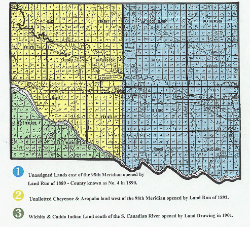
County known as "Number 4" in 1890.
Blue = Unassigned Lands east of the 98th meridian
opened by Land Run of 1889.
Yellow = Unallotted Cheyene and Arapaho land west of the 98th Meridian opened by Land Run of 1892
Green = Wichita & Caddo Indian Land south of the S. Canadian River opened by Land Drawing of 1901.