
Maps
'n' More
Created
By
Sharon McAllister

|
|
Maps
'n' More |
|
|
|
||
|
|
|
||
|
|
|
|
|
|
|
|
|
|
|
|
|
|
|
|
|
|||
| Back to Washington Co. Map Links |
1915 Atlas
Washington County
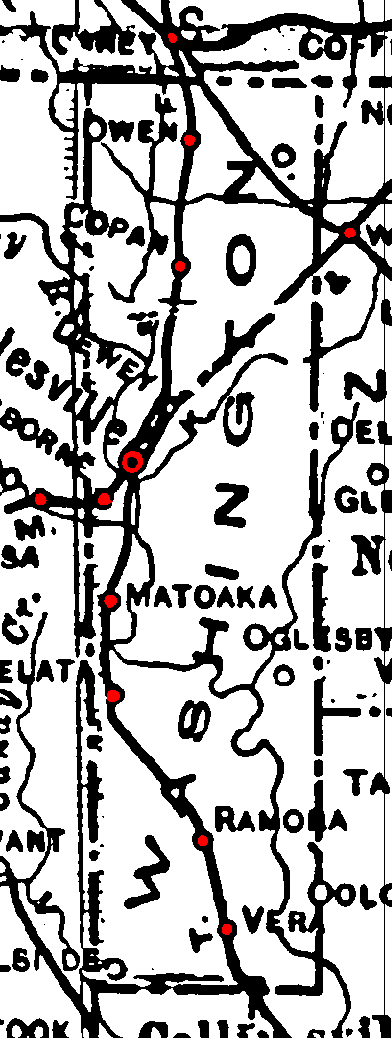
Railroad Stations are shown in red.
The north/south line was the Atchison, Topeka & Santa Fe. It was still operational in 1972.
The one cutting southwest/northeast was the Missouri, Kansas & Texas. It was still operational in 1972.
The O & T cut through the northeast corner. It had been abandoned by 1972.
The Atlas shows no roads in Washington County. The thin lines are rivers and creeks.
![]()
|
Page last updated
on
Tuesday, July 21, 2026
This site maintained by
Mel Owings
![]()