
Maps
'n' More
Created
By
Sharon McAllister

|
|
Maps
'n' More |
|
|
|
||
|
|
|
||
|
|
|
|
|
|
|
|
|
|
|
|
|
|
|
|
|
|||
| Back to Roger Mills Co. Map Links |
1915 Atlas
Roger Mills County
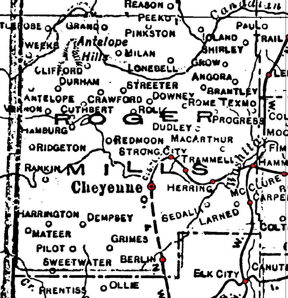
Railroad Stations are shown in red.
The north/south line that passed through the east side was the W. F. & N. W., which was later acquired by the M. K. T. and abandoned by 1972. (This segment as also been identified as part of the Choctaw, Oklahoma and Western, network, but I have not been able to verify this.)
The line extending eastward from Strong City was the Clinton and Oklahoma Western. It was later acquired by the Santa Fe and was still in operation in 1972.
The planned north/south line from Cheyenne was the O. & N.W., which was to connect with the east/west Chicago, Rock Island & Pacific in neighboring Beckham County. If it was actually built, it had been abandoned by 1972.
The planned line from Cheyenne to Strong City was the C. S. L., or Cheyenne Short Line. It was later acquired by the Santa Fee and was still in operation in 1972.
The Atlas shows no roads in Roger Mills County. The thin lines are rivers and creeks.
![]()
|
Page last updated
on
Tuesday, July 21, 2026
This site maintained by
Mel Owings
![]()