
Maps
'n' More
Created
By
Sharon McAllister

|
|
Maps
'n' More |
|
|
|
||
|
|
|
||
|
|
|
|
|
|
|
|
|
|
|
|
|
|
|
|
|
|||
| Back to Oklahoma County Township Maps | Back to Oklahoma County Cemetery Lists |
Oklahoma County - T13N-R3W
Click on Cemetery Name for links to online information such as canvasses.
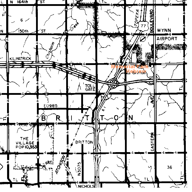
| Cemetery | Directions/Comments/Links | Sec | Latitude | Longitude | Quad |
| Memorial Park | South of Memorial Road and east of Kelly. Go to GNIS Map. | 14 | 353619N | 0972928W | Spencer |
| Hebrew | South of Memorial Park, east of Kelly. Go to GNIS Map. | 14 | 353607N | 0972937W | Spencer |
![]()
|
Page last updated
on
Tuesday, July 21, 2026
This site maintained by
Mel Owings
![]()