
Maps
'n' More
Created
By
Sharon McAllister

|
|
Maps
'n' More |
|
|
|
||
|
|
|
||
|
|
|
|
|
|
|
|
|
|
|
|
|
|
|
|
|
|||
| Back to Oklahoma County Township Maps | Back to Oklahoma County Cemetery Lists |
Oklahoma County - T13N-R2W
Click on Cemetery Name for links to online information such as canvasses.
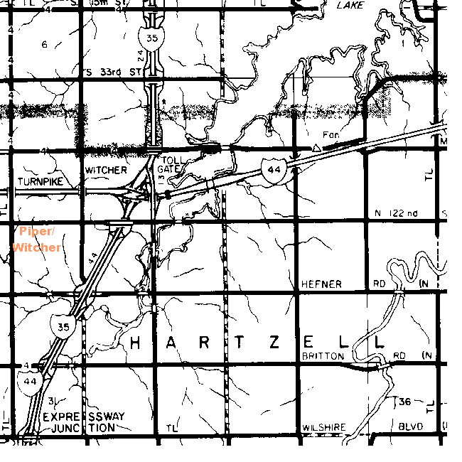
| Cemetery | Directions/Comments/Links | Sec | Latitude | Longitude | Quad |
| Piper | NW 1/4 Sec 19-13N-2W Spencer USGS 7.5 minute map On south side of NE 122nd Street, 1 mile west of I-35. Go to GNIS Map. Piper Canvass | 19 | 353539N | 0972703W | Spencer |
| Witcher | See Piper. |
![]()
|
Page last updated
on
Tuesday, July 21, 2026
This site maintained by
Mel Owings
![]()