
Maps
'n' More
Created
By
Sharon McAllister

|
|
Maps
'n' More |
|
|
|
||
|
|
|
||
|
|
|
|
|
|
|
|
|
|
|
|
|
|
|
|
|
|||
| Back to Oklahoma County Township Maps | Back to Oklahoma County Cemetery Lists |
Oklahoma County - T12N-R1E
Click on Cemetery Name for links to online information such as canvasses.
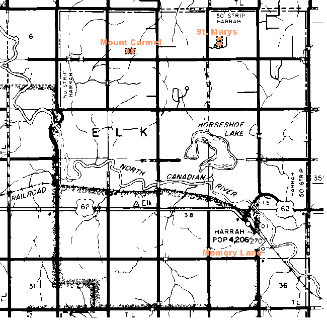
| Cemetery | Directions/Comments/Links | Sec | Latitude | Longitude | Quad |
| Memory Lane | Take I-40 east from Oklahoma City to Harrah Newalla Road, exit 172. Go north on Harrah Newalla Road about 6.5 miles. The cemetery is on the north side of NE 10th Street, about 1/2 mile west of Harrah Road. | 26 | |||
| Mount Carmel | See Map. Go to GNIS Map. Mount Carmel Canvass | 4 | 353211N | 0971208W | Horseshoe Lake |
| St Marys Unkrainian | See Map. Go to GNIS Map. St. Mary's Ukrainian Canvass | 2 | 353222N | 0971034W | Horseshoe Lake |
![]()
|
Page last updated
on
Tuesday, July 21, 2026
This site maintained by
Mel Owings
![]()