
Maps
'n' More
Created
By
Sharon McAllister

|
|
Maps
'n' More |
|
|
|
||
|
|
|
||
|
|
|
|
|
|
|
|
|
|
|
|
|
|
|
|
|
|||
| Back to Cherokee Co. Map Links |
1915 Atlas
Cherokee County
![]()
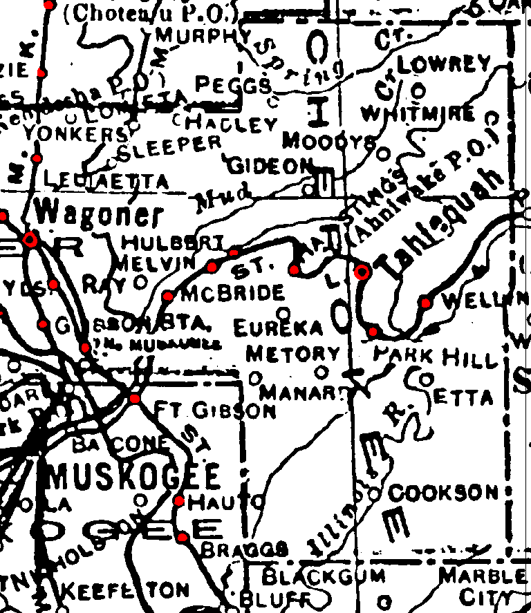
Railroad Stations are shown in red.
The north/south line through the western part of the county was the Missouri, Kansas and Texa.
The others were the St. Louis and San Francisco.
The Atlas shows no roads in Cherokee County. The thin lines are rivers and creeks.
![]()
|
Page last updated
on
Tuesday, July 21, 2026
This site maintained by
Mel Owings
![]()