

| OKGenWeb | ITGenWeb | |||||
| |
|||||
| Cultural Areas | Migrations | Removals | State Links | Timeline Maps | Trails & Roads |
| Indian Country Home Page | Postal Routes of 1903 | 1900 Census EDs | |||
|
|
|||||
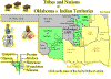
Oklahoma, Indian Territory and Oklahoma Territory Maps
|
OKGenWeb Special Project |
|
Maps-N-More
|
|
|
|
State Map - current day counties (clickable) |
 |
State Map - pre-statehood areas (clickable) |
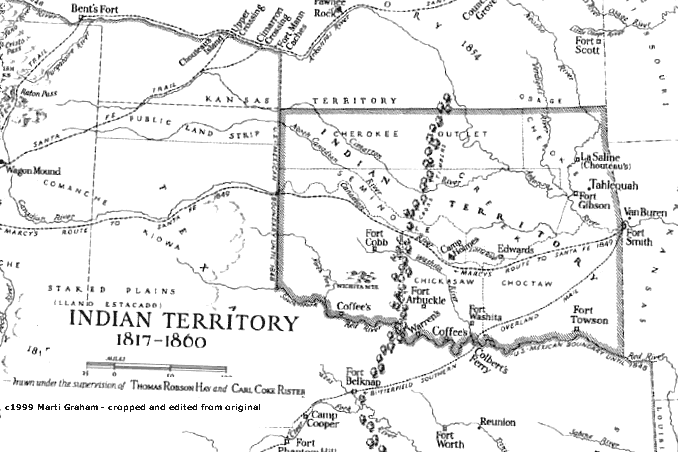 |
1817-1860 Indian Territory |
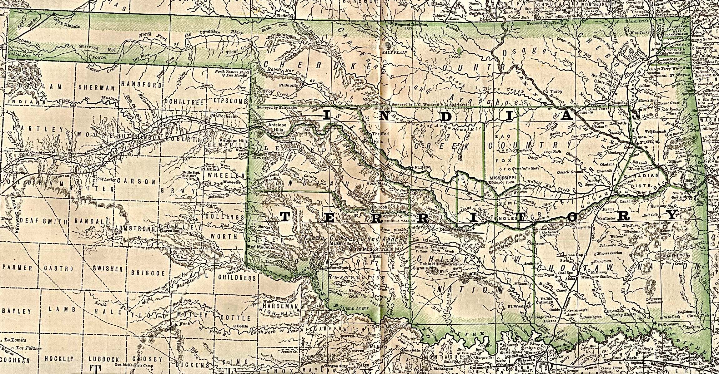 |
1884 Indian Territory |
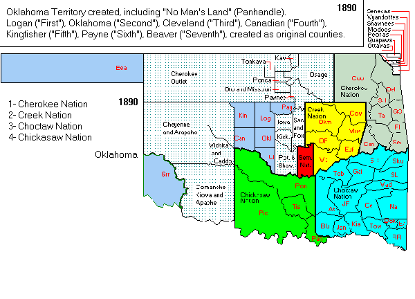 |
1890 Oklahoma - Indian Territory Map |
 |
1895 - Atlas
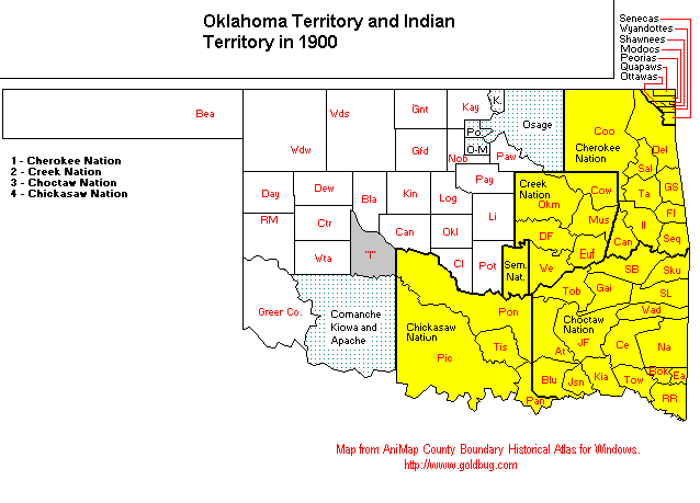
Oklahoma Territory - Indian Territory
Key to the 1895 Atlas, matching its pages to present-day counties |
 |
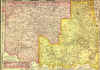
1899 Oklahoma - Indian Territory Map |
 |
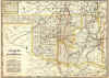
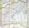
1900 Oklahoma - Indian Territory Map
|
 |
Indian Territory - A sequence of maps showing the changing westward boundaries from colonial times to the the formal organization of Indian Territory in preparation for admittance to the Union. |
| Oklahoma | |
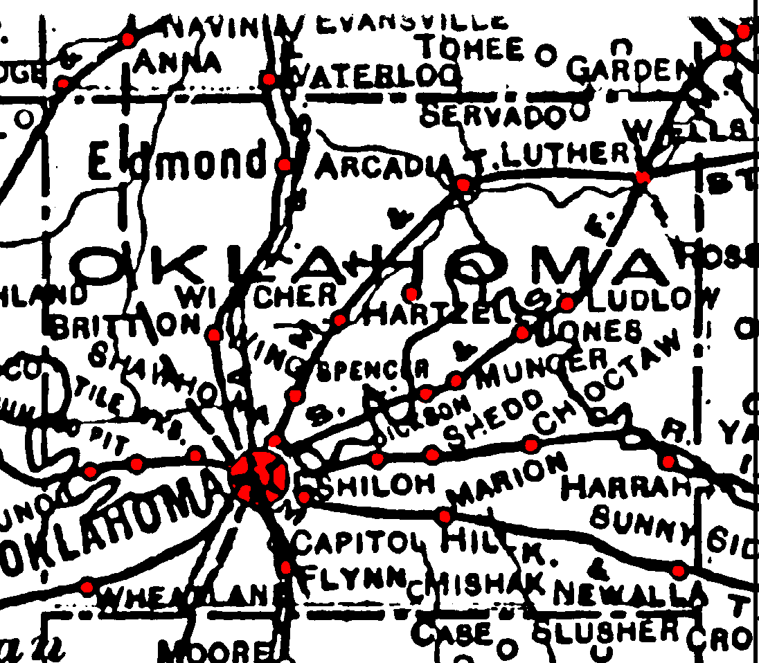 |
1915 County Maps |
|
|
Railroad Maps from 1915 |
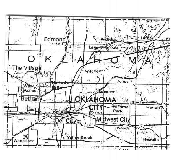 |
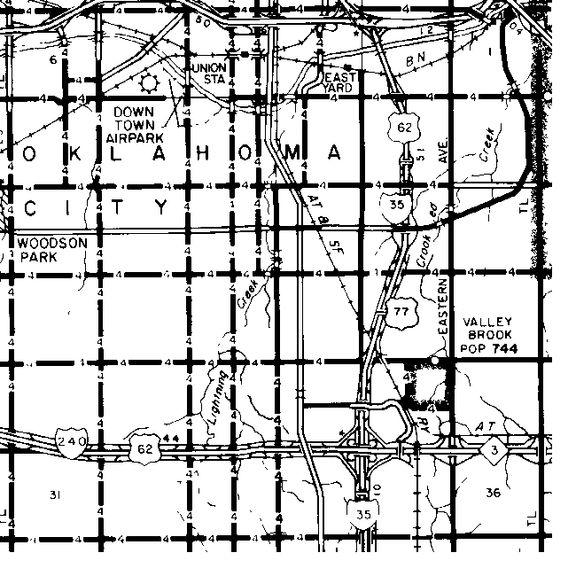
USGS Maps from 1972 |
 |
Current Maps - showing township and range |
| Cherokee Nation | |
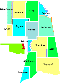 |
Cherokee Nation 14 counties map |
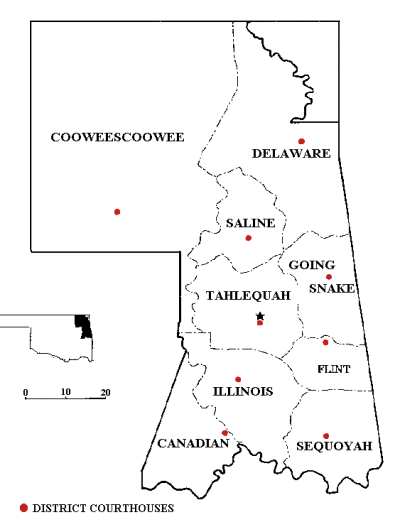 |
Cherokee Nation Judicial Districts |
| Choctaw Nation | |
 |
Choctaw Nation Political Sub-Divisions |
 |
1900 Choctaw Nation Historic Maps |
 |
1902 Choctaw Nation |
| Creek Nation | |
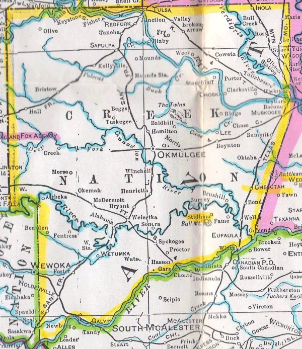 |
1900 Creek Nation |
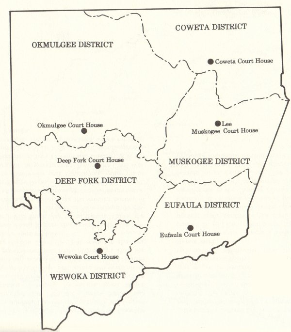 |
Creek Nation Political Divisions |
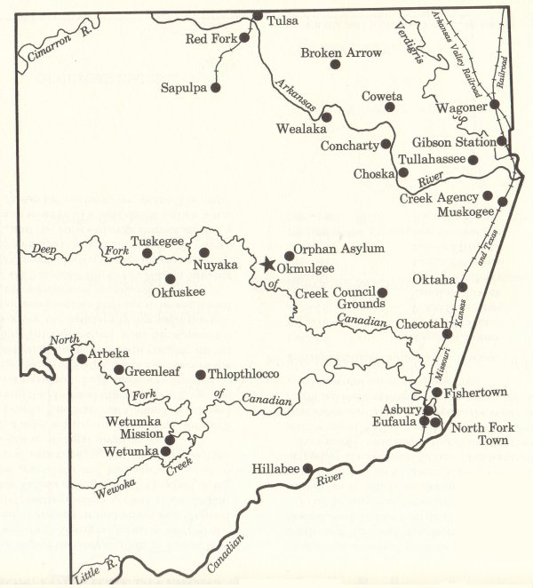 |
Creek Nation Towns |
| Chickasaw Nation | |
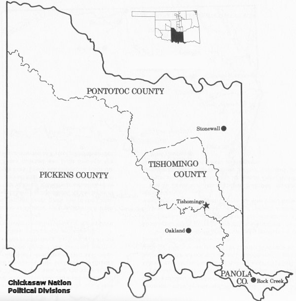 |
Chickasaw Political Subdivisions |
| Oklahoma Territory | 1895 - Atlas
Oklahoma Territory - Indian Territory
Key to the 1895 Atlas, matching its pages to present-day counties |
| Oklahoma Township Maps (partially completed project) |
|
Your OKGenWeb Team |
Last updated
03/17/2008 |
Copyright 1996 - The OKGenWeb速 Project | Linda Simpson, State Coordinator | |