|
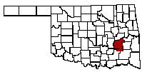
Pittsburg County |
|
 |
 |
 |
 |
 |
 |
04 Instructions for 10,000 Maps in the Oklahoma Historical Society
Steps
Directions
Example
Results
Notes
1
URL
2
Select: "Archives Catalog"
If you want to follow the instruction - you will want to open this in another tab - to do this hover over URL and right click and select: Open link in a new tab
3
Select "O" In Browse Collections
4
Scroll to: "Oklahoma Historical Society Map Collection"
Before you click - look at the other entries - is there somthing interesting - now finish this process and return later when you know how to use it
5
Upper left, click on "+" in +Maps
Clicking on + gives a different screen than clicking on Maps - clicking on Maps is a dead end
6
Choose a map collection by clicking on "+" in front to it
I choose Military and Battle maps
Same applies here clicking on the description of the maps will gety you lost clicking on the + will get whe you want
7
Click on the map
I choose Civil War Map - Battle of Honey Springs
8
Click on map image to enlarge
HISMAP.0098 Civil War Map - Battle of Honey Springs. 1863/07/13.
9
Right click on the enlarged image and "Save Image as..."
10
Select the type of file you want
I use: JPEG file(*.jPG)
11
Modify the file name for your needs
I used: 1863 07 17 Battle map
12
Find the file folder you want to place the image into
I used: Honey Springs
13
Click save - lower right
Check it out
Last Update: 07-Dec-2016 9:19 PM | |
OKGenWeb/ITGenWeb is part of the USGenWeb Project. Links to web sites that are not part of USGenWeb Project are provided for your convenience and do not imply any endorsement of the websites or their contents by The USGenWeb Project. | |
WebMaster Robert O. Pulse: rop720@aol.com | |
State Coordinator: Linda Simpson Asst. State Coordinator: Mel Owings |