click for larger map
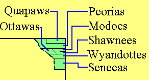
Quapaw Lands In Arkansas
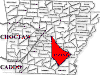
Pottawatomie County Kansas
Pre Statehood Map
Oklahoma & Indian Territory Maps
If you have data to contribute or would like to help with this site, please contact me. Home Linda Simpson Updated: 21 Mar 2008 Visitor: 3522. ©1999 - 2006 OKGenWeb All Rights Reserved
If you have data to contribute or would like to help with this site, please contact me.
Home Linda Simpson Updated: 21 Mar 2008 Visitor: 3522. ©1999 - 2006 OKGenWeb All Rights Reserved