|
Find any bugs? Please Report broken links! |
 |
|
© 1997-2004 OKGenWeb - Marti Graham-Cripps This page maintained by Sharon McAllister |
|
|
|
|
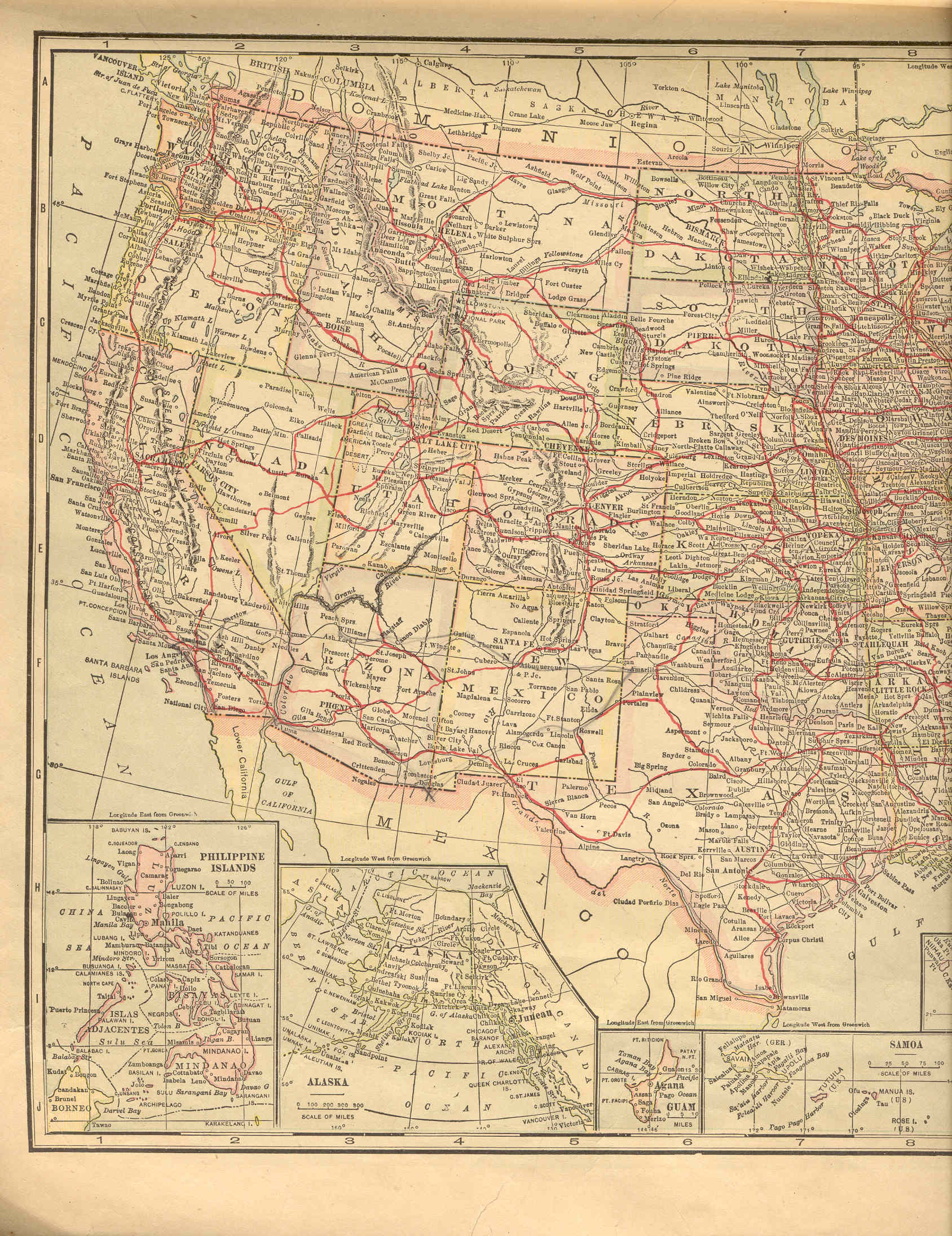
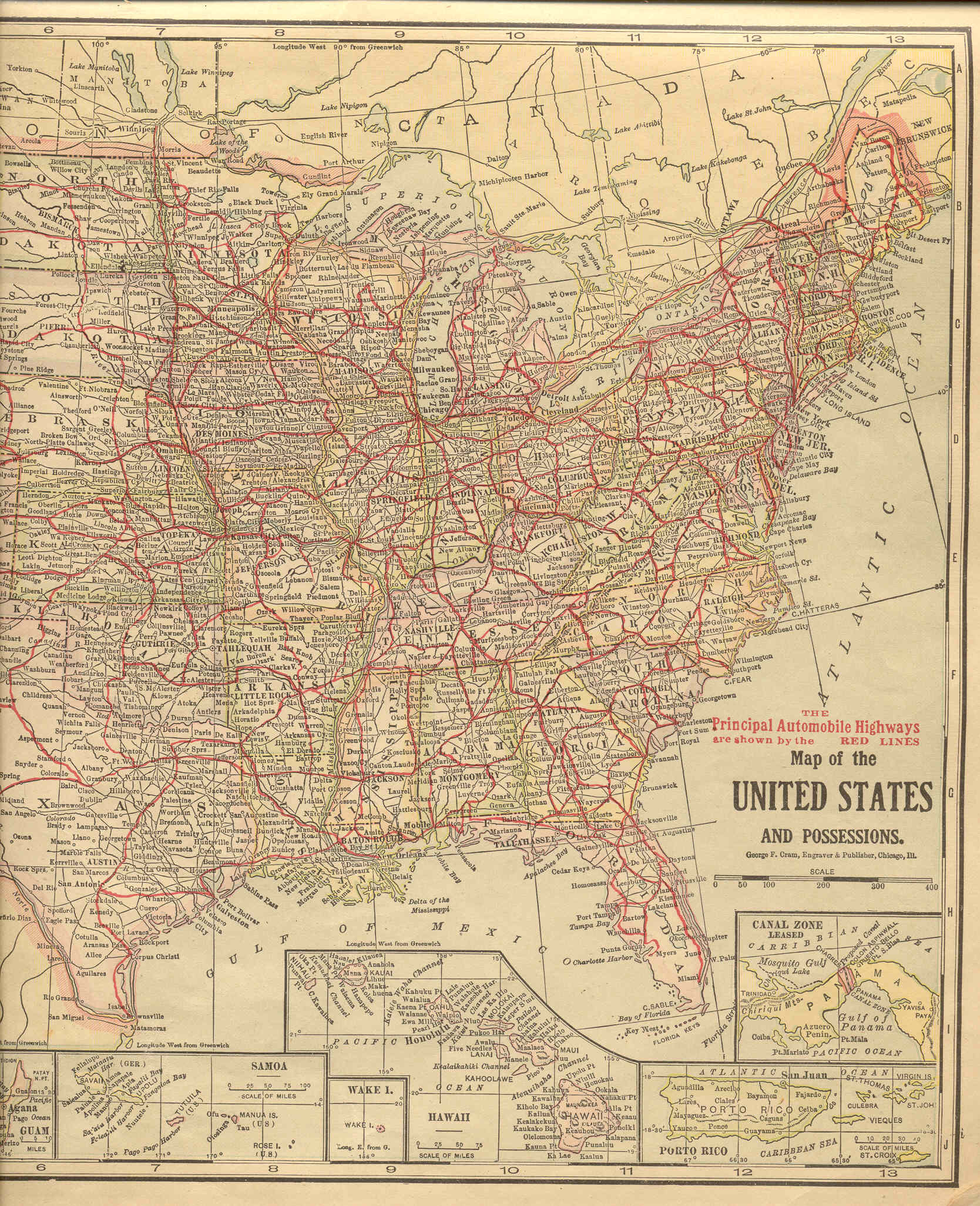
The 1915 Transportation Atlas provides a single nation-wide map for highways, showing Principal Highways in red and some of the major railroads in black. This map is so large that it had to be scanned in two parts, but there is enough overlap that all of Oklahoma appears on the western half and all but the tip of the panhandle on the eastern half. There are some pencil marks on the western portion, made to show the general location of later highways because it was used for a trip from Oklahoma to California in the early 1930s.
| ||||
| ||||