
Maps
'n' More
Created
By
Sharon McAllister

|
|
Maps
'n' More |
|
|
|
||
|
|
|
||
|
|
|
|
|
|
|
|
|
|
|
|
|
|
|
|
|
|||
| Back to Sequoyah County Township Maps | Back to Sequoyah County Cemetery Lists |
Sequoyah - T13N-R22E
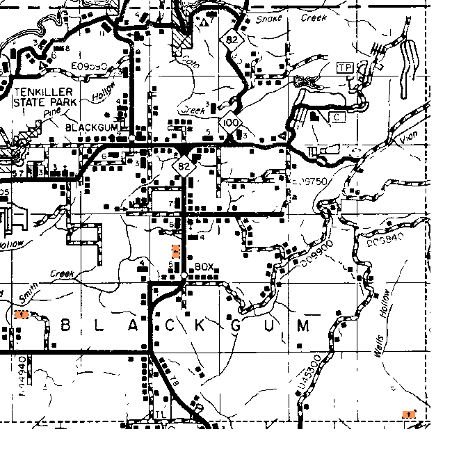
| Cemetery | Directions/Comments/Links | Sec | Latitude | Longitude | Quad |
| Barnisky Cemetery | Not shown on this map but is on the topographical map. Barnoskie Canvass | 14 | 353624N | 0945555W | Blackgum |
| Cherokee-McCoy Cemetery | See Above Map. Cherokee-McCoy Canvass | 36 | 353701N | 0945429W | Blackgum |
| Memorial Church | See Above Map | 21 | |||
| Red Bird Cemetery | See Above Map. Red Bird Canvass | 30 | 353425N | 0950057W | Gore |
The Northern Boundary is near 35º38' and the Southern Boundary is between 35º33' and 35º34', so Vian can't be in this township and Cedar Grove may not be.
The Western Boundary is near 95º01' and the Eastern Boundary is near 94º55'.
Click on cemetery name for more details from GNIS. Use Lat/Long and Quad name for consulting conventional maps or searching Terraserver and Topozone for cemeteries not shown here.
![]()
|
Page last updated
on
Saturday, April 25, 2026
This site maintained by
Mel Owings
![]()