
Maps
'n' More
Created
By
Sharon McAllister

|
|
Maps
'n' More |
|
|
|
||
|
|
|
||
|
|
|
|
|
|
|
|
|
|
|
|
|
|
|
|
|
|||
| Back to Ottawa Co. Map Links |
1915 Atlas
Ottawa County
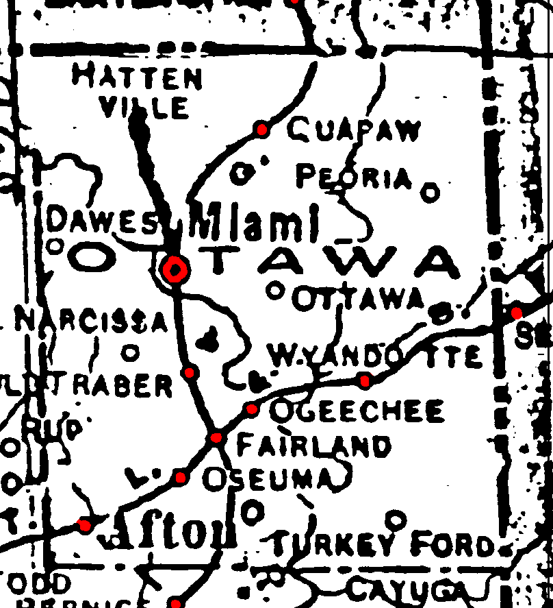
Railroad Stations are shown in red.
The north/south line was the Kansas, Oklahoma and Gulf. The southern part had been abandoned by 1972, but the St. Louis and San Francisco was still operating the part north of Fairland.
The east/west line was the St. Louis and San Francisco.
The thick line that goes north from Miami to Hattenville is actually a trolley.
The thinner lines are rivers or creeks.
![]()
|
Page last updated
on
Tuesday, June 30, 2026
This site maintained by
Mel Owings
![]()