
Maps
'n' More
Created
By
Sharon McAllister

|
|
Maps
'n' More |
|
|
|
||
|
|
|
||
|
|
|
|
|
|
|
|
|
|
|
|
|
|
|
|
|
|||
| Back to Oklahoma County Township Maps | Back to Oklahoma County Cemetery Lists |
Oklahoma County - T11N-R1W
Click on Cemetery Name for links to online information such as canvasses.
| Cemetery | Directions/Comments/Links | Sec | Latitude | Longitude | Quad |
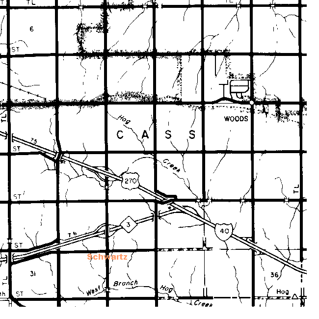
| Located at SE 89th Street and Anderson Road in southeast Oklahoma City. Take I-40 or I-240 east from the city. Take the Anderson Road exit and go south to 89th Street. Go to GNIS Map Schwartz Canvass | 32 or 33 | 352236N | 0971901W | Choctaw |
Kear. This cemetery is located on SE 104th Street, west of Anderson Rd, on the north side. From I-40 or I-240, go east from the city. Take the Anderson Rd exit. Go south on Anderson Rd to SE 104th (stop sign). Go west (right) on SE 104th about 1/2 mile. This cemetery was created from land that was part of Charles Ford's original Land Run homestead. It has been owned by the Kear family for the last 100 years. It is a closed community cemetery, allowing burials only of relatives of people already buried there. This is in the community of Schwartz (part of far SE Oklahoma City) and used to be known as Union Grove community. There are several graves marked only with rocks. A number of these are World War I soldiers that were killed in battle. This is apparently in Cleveland instead of Oklahoma County.
![]()
|
Page last updated
on
Tuesday, June 30, 2026
This site maintained by
Mel Owings
![]()