
Maps
'n' More
Created
By
Sharon McAllister

|
|
Maps
'n' More |
|
|
|
||
|
|
|
||
|
|
|
|
|
|
|
|
|
|
|
|
|
|
|
|
|
|||
| Back to Hughes County Township Maps | Back to Hughes County Cemetery Lists |
Hughes - T4N-R9E
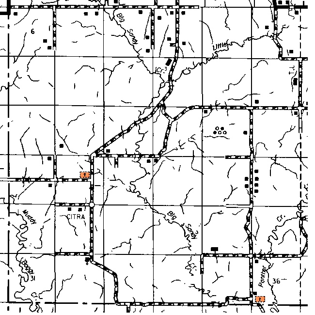
The cemetery in Section 20 is shown on the topographic map as Citra and the one in Section 36 as Panther Creek.
| Cemetery | Sec | Latitude | Longitude | Quad | |||
| Citra Cemetery | OK | Hughes | cemetery | 20 | 344817N | 0962237W | Steedman |
| Panther Creek Cemetery | OK | Go 1/2 mile south 1 mile west of Gerty on county road EW151 to county road NS376. Go south on NS 376 4.2 miles to dead end. Locked gate. Cemetery north and east of road about 200 ft. | cemetery | 36 | 344602N | 0961903W | Gerty |
Click on cemetery name for more details from GNIS. Use Lat/Long and Quad name for consulting conventional maps or searching Topozone.
![]()
|
Page last updated
on
Tuesday, June 30, 2026
This site maintained by
Mel Owings
![]()