
Maps
'n' More
Created
By
Sharon McAllister

|
|
Maps
'n' More |
|
|
|
||
|
|
|
||
|
|
|
|
|
|
|
|
|
|
|
|
|
|
|
|
|
|||
| Back to Hughes County Township Maps | Back to Hughes County Cemetery Lists |
Hughes - T4N-R11E
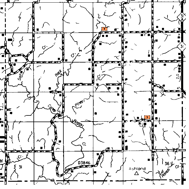
The topographic map shows the cemetery in Section 3 is Rock Creek and the one in Sec 23 is across the road from the Bohannon Church.
| Sec | Latitude | Longitude | Quad | ||||
| Rock Creek Cemetery | OK | Hughes | cemetery | 3 | 345027N | 0960816W | Non |
Click on cemetery name for more details from GNIS. Use Lat/Long and Quad name for consulting conventional maps or searching Topozone.
![]()
|
Page last updated
on
Tuesday, June 30, 2026
This site maintained by
Mel Owings
![]()