
Maps
'n' More
Created
By
Sharon McAllister

|
|
Maps
'n' More |
|
|
|
||
|
|
|
||
|
|
|
|
|
|
|
|
|
|
|
|
|
|
|
|
|
|||
| Back to Grant Co. Map Links |
1915 Atlas
Grant County
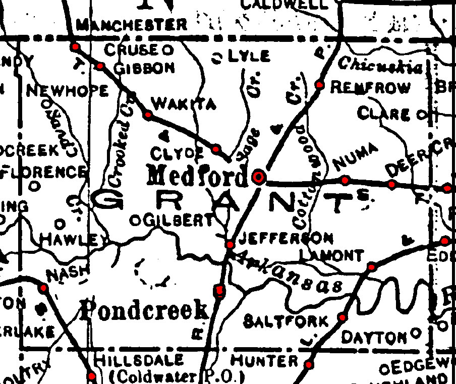
Railroad Stations are shown in red.
The north/south line was the Chicago, Rock Island and Pacific. It was still operational in 1972.
The east/west line through the northern part of the county was the Atchison, Topeka and Santa Fe. It was still operational in 1972.
The two lines through the southwest and southeast corners were the St. Louis and San Francisco. Both were still operational in 1972.
The Atlas shows no roads in Grant County. The thin lines are rivers and creeks.
![]()
|
Page last updated
on
Tuesday, June 30, 2026
This site maintained by
Mel Owings
![]()