
Maps
'n' More
Created
By
Sharon McAllister

|
|
Maps
'n' More |
|
|
|
||
|
|
|
||
|
|
|
|
|
|
|
|
|
|
|
|
|
|
|
|
|
|||
| Back to Dewey Co. Map Links |
1915 Atlas
Dewey County
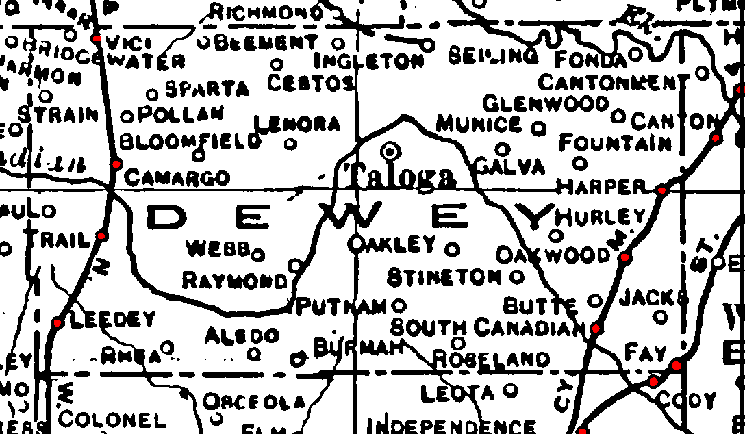
Railroad Stations are shown in red.
The north/south line was the W. FS. & N. W. Later taken over by the M. K. T., but abandoned by 1972.
The Kansas City, Mexico and Orient cut through the southeastern portion of the county. Later acquired by the Santa Fe, it was still operational in 1972.
The St. Louis and San Francisco went through the southeastern corner at Fay. It was still operational in 1972.
The proposed line from Ingleton to Alton, in neighboring Woodward County, was not named.
The Atlas shows no roads in Beckham County. The thin lines are rivers and creeks.
![]()
|
Page last updated
on
Saturday, June 27, 2026
This site maintained by
Mel Owings
![]()