
Maps
'n' More
Created
By
Sharon McAllister

|
|
Maps
'n' More |
|
|
|
||
|
|
|
||
|
|
|
|
|
|
|
|
|
|
|
|
|
|
|
|
|
|||
| Back to Cotton Co. Map Links |
1915 Atlas
Cotton County
![]()
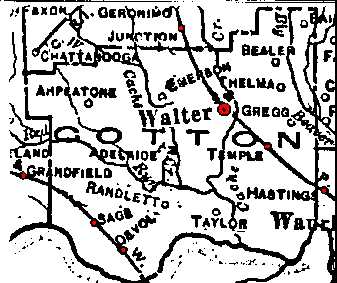
Railroad Stations are shown in red.
The northwest/southeast line through Walter(s) was the Chicago, Rock Island and Pacific. It was still operational in 1972.
The line through the southwestern part of the county was the W. F. & N. W. Later taken over by the M. K. T. and still operational in 1972.
The Atlas shows no roads in Cotton County. The thin lines are rivers and creeks.
![]()
|
Page last updated
on
Tuesday, June 30, 2026
This site maintained by
Mel Owings
![]()