
Maps
'n' More
Created
By
Sharon McAllister

|
|
Maps
'n' More |
|
|
|
||
|
|
|
||
|
|
|
|
|
|
|
|
|
|
|
|
|
|
|
|
|
|||
| Back to Coal Co. Map Links |
1915 Atlas
Coal County
![]()
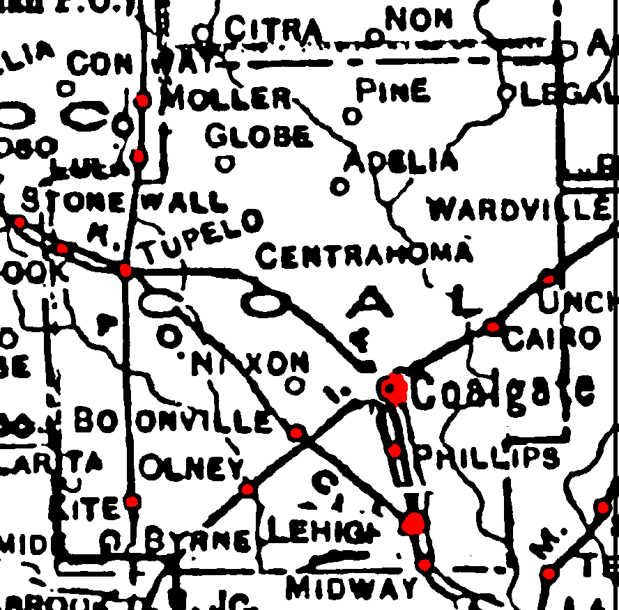
Railroad Stations are shown in red.
The north/south line was the M. O. & G., Missouri Pacific. It was still operating in 1972 as the Missouri Pacific.
The line running southwest/northeast was the Chicago, Rock Island & Pacific. It had been abandoned by 1972.
The one running northwest/southeast was the O. C. A. & A. It had been abandoned by 1972.
The double line between Coalgate and Lehigh is not labeled, but had been abandoned by 1972.
The Atlas shows no roads in Coal County. The thin lines are rivers and creeks.
![]()
|
Page last updated
on
Tuesday, June 30, 2026
This site maintained by
Mel Owings
![]()