
Maps
'n' More
Created
By
Sharon McAllister

|
|
Maps
'n' More |
|
|
|
||
|
|
|
||
|
|
|
|
|
|
|
|
|
|
|
|
|
|
|
|
|
|||
| Back to Cleveland Co. Map Links |
1915 Atlas
Cleveland County
The boundary between the two counties is not clear because it follows the Canadian River, which meanders through the map from upper left to lower right, dividing Cleveland County (to the northeast of the river) from McClain County (to the southwest).
![]()
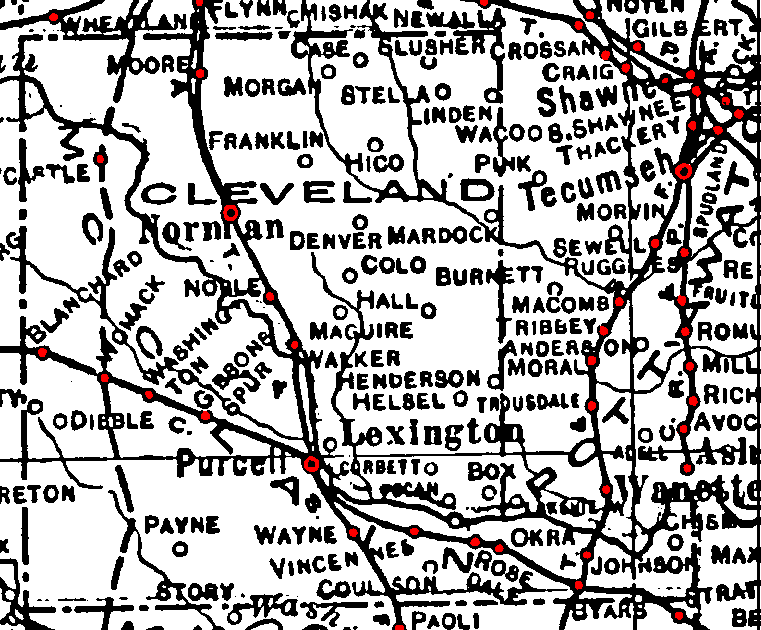
Railroad Stations are shown in red.
The north-south line was the Atchison, Topeka & Santa Fe. It was still operational in 1972.
The wide line indicates a trolley that paralleled the Atchison, Topeka & Santa Fe from Norman through Moore to Oklahoma City.
See the adjoining counties for the other railroads shown here that did not actually pass through Cleveland County.
Thin lines are rivers and creeks.
![]()
|
Page last updated
on
Friday, July 03, 2026
This site maintained by
Mel Owings
![]()