
Maps
'n' More
Created
By
Sharon McAllister

|
|
Maps
'n' More |
|
|
|
||
|
|
|
||
|
|
|
|
|
|
|
|
|
|
|
|
|
|
|
|
|
|||
| Back to Blaine Co. Map Links |
1915 Atlas
Blaine County
![]()
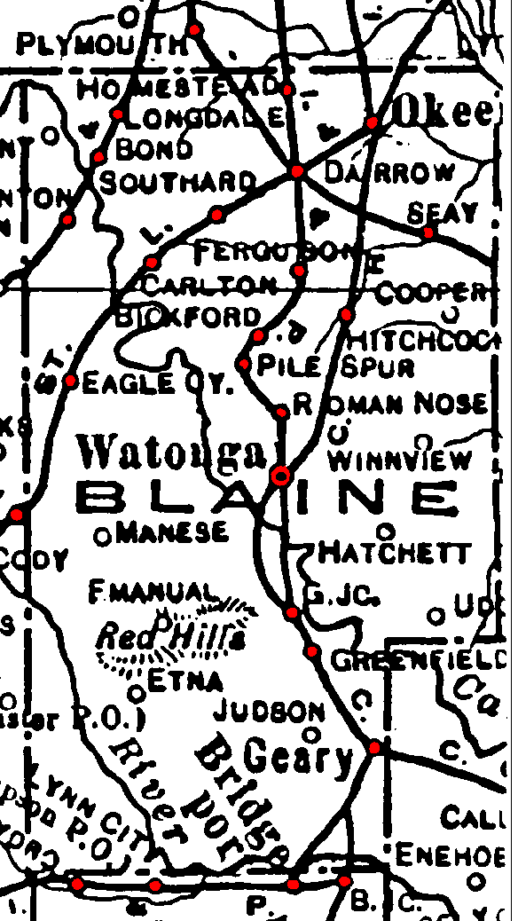
Railroad Stations are shown in red.
The line through the northwest corner was the Kansas City, Mexico and Orient. Later acquired by the Santa Fe, it was still operational in 1972.
The southwest/northeast line was the St. Louis and San Francisco. It was still operational in 1972.
Both north/south lines and their spurs were the Chicago, Rock Island & Pacific. A single north/south line, composed of various segments, was still operational in 1972.
The northwest/southeast line through the northeastern corner of the county is not labeled, but had been abandoned by 1972.
The Atlas shows no roads in Blaine County. The thin lines are rivers and creeks.
![]()
|
Page last updated
on
Saturday, May 16, 2026
This site maintained by
Mel Owings
![]()