
 |
Pontotoc County |
 |
|
Home |
Archives
|Towns
| Cemeteries|
Marriages |
Queries | Photos |
Schools |
Obits | Links |
Resources |
||
"Links to web sites that are not part of the USGenWeb Project are provided for your convenience and do not imply any endorsement of the web sites or their contents by The USGenWeb Project."
Oklahoma Ghost Towns
by
Mike Taylor
![]()
Maybe the town still exists! Try this
first.
Search the USGS
GNIS server
Couldn't find it? Well, try these files.
Town names beginning with:
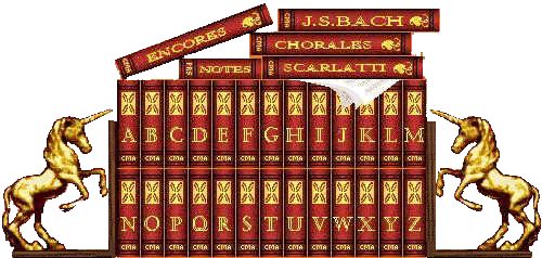
Click On The Book With Letter Town Name Starts With, example Guthrie = Book G
![]()
The entire data base in PKZIPW format sorted by County, Town.
OKTOWNS.ZIP
Note: These lists were mostly created by scanning the book "Town and Place Locations", published by the Oklahoma Department of Transportation. After scanning, Optical Character Resolution (OCR) was employed to render the image files into textural data files. Town and county names were rendered most accurately. The Location data was the most difficult to render in exact form. Poorly formed characters made an "I" out of a "1", and a "0" out of an "8", for example. Some proofing was done to correct these mistakes, but no 'guarantees' are made!
![]()
OK! I found the place, now where is it?
Map of Oklahoma showing Counties, Lat/Long, and Base Lines (193K Gif)
Oklahoma County Maps in TIFF format
Definition of Legal Land Descriptions in the United States
![]()
OK Gen Web County Sites with Town Histories
| Latimer | LeFlore | Pontotoc |
![]()
Reference Material
"Oklahoma Place Names" by George H. Shirk. About 10 names to the page and 200 pages. Each location/history is just a few lines about the town and when/if post office was established. Even has tidbits of info about each county.
"Ghost Towns of Oklahoma" by John W. Morris is more appropriate for details of a listed ghost town, usually 1-2 pages of info.
"Digital Atlas of Oklahoma" by Oklahoma Geological Survey. New CD out. Found in Daily Oklahoman newspaper, April 24, 1997: The Digital Atlas of Oklahoma is available at the Oklahoma Geological Survey Office, 100 E. Boyd, Room N-131, Norman, OK 73069. (405-325-3031). Fully searchable, cost $5.00. IBM compatible, 17 MB Disk Space required, software included to read. Can find cities, streets, rivers, creeks, etc.
"Town and Place Names", by Oklahoma Department of Transportation. Address: Reproduction Branch, 200 N. E. 21st Street, Oklahoma City, OK 73105-3204. $1.50, plus postage. Also, Oklahoma County Maps, $0.50 each, plus postage.
![]()
Updated on 09/26/11
 |
|
|
|
|


God Bless America
Hosted & ©2024 by:
OKGenWeb State Coordinator
Linda
Simpson
Asst: Mel Owings
© 1996-Present ~ All Rights Reserved
| USGenNWeb NOTICE: In keeping with our policy of providing free Information on the Internet, data may be used by non-commercial entities, as long as this message remains on all copied material. These electronic pages may NOT be reproduced in any format for profit or for presentation by other persons or organizations. Files may be printed or copied for Personal use only. Persons or organizations desiring to use this material for purposes other than stated above must obtain the written consent of the file contributor. |