|
|
|
|
|
|
|
|
|
|
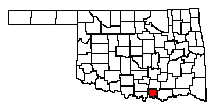
Marshall County |
|
Before and After Statehood
In 1837, the Chickasaw Nation and the Choctaw Nation were created in Indian Territory. The Chickasaw Nation was divided into four counties, Pickens, Pontotoc, Tishomingo, and Panola. The Chickasaw Nation included whole or part of the following present counties: Carter, Love, Marshall, Garvin, Grady, Stephens, Jefferson, Murray, Johnston, Pontotoc, McClain, Coal and BRYAN. Pickens County, Indian Territory included the following counties: Carter, Love, MARSHALL, and portions of Garvin, Grady, Stephens, Jefferson, Murray, and Johnston. In September of 1844, the first newspaper in Oklahoma/Indian Territory was published the Cherokee Advocate. It was printed in both English and Cherokee. In 1845, the government annexed the Republic of Texas, which included the panhandle of Oklahoma. In 1850, the panhandle became known as "No Man's Land", because when the government purchased the land from Texas it was not attached to any state or territory. Finding individuals before statehood is not an easy task for several reasons. The earliest federal census of the area that is now Oklahoma is the 1860 census of Arkansas, which included what was then Indian Territory. This census lists free and slave inhabitants in the Cherokee, Choctaw, Creek, and Seminole nations not Indians. However, before 1889 only a few thousand non-Indians lived in the area. Non-Indians needed permission from the Indians to live in the area, although some white settlers moved into the area without permission. After the Civil war in 1866, new treaties with the Five Civilizedtribes allowed the government to move more tribes to the area. The new treaties realigned tribal land boundaries and the land allotted to the Five Civilized tribes were almost cut in half. Thus creating "unassigned lands" which would later be opened to white settlers for settlement. Sadly, the 1870 and 1880 censuses for present day Oklahoma were lost and the 1890 federal census was destroyed.
The land runs of the Unassigned lands began in April of 1889. Land not assigned to Indian tribes in Indian Territory became part of the public domain. The land was surveyed by the government and opened for settlement by Non-Indians creating what is known as "land runs." Large amounts of land were opened for settlement on a certain day and were claimed on a first-come basis. This created "runs" to stake claims to sections of land. Individuals could claim the land throughcash purchases or by homesteading the land. The Homestead Act went into effect on January 1, 1863, which was a major incentive for many individuals to settle in the west. The Homestead Act stated that the individual staking the claim had to be either the head of a family, 21 years old, or a veteran of 14 days of active service in the U.S. armed forces. Also, the homesteader had to be a citizen or had to have filed a declaration of intent to become a citizen before acquiring a tract of land in the public domain not exceeding 160 acres. To acquire a title to the land the homesteader, was obliged to settle on or cultivate the homestead for five years. The first land offices were established in Guthrie and Kingfisher. Additional land was opened to land runs in September of 1891, April of 1892, September of 1893, and May of 1895. Some of the lands opened for the land runs were previously parts of reservations of various Indian tribes in the western part of the state. The panhandle known as "No Man's Land" was added to the public domain and opened for settlement in 1890. The railroad companies and white settlers were behind the pressure on the government to open "unassigned lands" for settlement. Oklahoma Territory was created in 1890. From 1890 to 1906,Oklahoma Territory expanded to include, several reservations in central Oklahoma, Cheyenne and Arapaho land, the Cherokee Outlet, Greer county, and Comanche, Kiowa , and Apache lands. The government conducted a census of the Chickasaw Nation in 1890. Also, in 1890, the federal government conducted a census of Union Veterans and Widows in Indian Territory. In addition, to the federal territorial censuses, a separate census was taken in 1890 of the Oklahoma Territory. In 1900, the government conducted a census of Indian Territory. In 1901, some western reservation land was distributed by land lotteries. In 1907, the "twin territories", Oklahoma and Indian Territory were combined to form the state Oklahoma. Oklahoma divided the Chickasaw and Choctaw lands into several new counties. Bryan, Atoka, Choctaw, Coal, Haskell, Latimer, Leflore, Pushmataha, McCurtain, and Pittsburg County were all formed in 1907 out of Choctaw Lands. Bryan County was named for William Jennings Bryan. MARSHALL, Carter, Johnston, Pontotoc, Murray, McClain, Love, Garvin County were all formed in 1907 out of Chickasaw Lands. Census records are available to find individuals living in Oklahoma in or after 1900.
Marshall County was divided into several townships. In 1950, the townships were Taliaferro (Oakland and Madill), Little City (Odell and New Woodville), Willis (Kingston), Holford. In 1970, the county divisions changed to North Marshall and South Marshall. According to the 1970 census, the population of Marshall County was 7,682. In 1980, the population of the county jumped to 10,550. According to the 1990 census, the population of Marshall County was 10,829. The largest town Madill, had a population of 3,069. Kingston had a population of 1,237. Oakland had a population of 602. McBride had a population of 80. New Woodville had a population of 31.
The Red River has been a key factor in the history of Marshall County. The building of the Red River Bridge created numerous jobs for the area in the 1930's. A little later, the building of the Denison Dam, and the creation of Lake Texoma employed several Marshall County citizens. Marshall County is also part of an area known as Texomaland. Texomaland includes the land surrounding Lake Texoma on both the Oklahoma and Texas side. When searching for newspaper articles on individuals or events in Marshall County, be sure to search through the Texoma area papers. North Texas newspapers covered southern Oklahoma news worthy stories. For instance, search the Sherman Democrat which was founded August 1879 and the Denison Herald which was founded July 1889. In 1996, the two newspapers merged to form the Herald Democrat. Back issues of the Sherman Democrat are available at the Sherman Public Library, 421 North Travis Street in Sherman, Texas. The current newspaper in Madill is the Madill Record. Before the Madill Record, there was the Oakland News. In 1900, it was renamed the Madill News. The Madill Record is located at 211 Plaza in Madill, Oklahoma. The Marshall County Historical Society published a book "The Memories of Marshall County Oklahoma - Then and Now". The book is compiled of personal family histories of individuals who have lived in Marshall County. The book was published in 1988. The Madill Post Office is located at 223 West Lillie Blvd, in Madill Oklahoma. Marshall County has two funeral homes. Watts Funeral Home located on Highway 70E in Kingston, Oklahoma. The other funeral home is Watts Funeral Home in Madill located at 200 South First Street in Madill, Oklahoma. The Watts Funeral Home is family owned and operated. They only have records after 1926.
Need court or probate records for Marshall County, Oklahoma? From 1884 to 1889, check the Western District of Arkansas, they had jurisdiction over criminal and some civil matters in Indian Territory. In 1889 the U.S. District Court for the Eastern District of Texas assumed the jurisdiction. After 1890, check the county court records, because the Territory was divided into several court districts that serve as county courts. Copies of court records can be obtained by contacting the clerk's office in the appropriate county courthouse. Official records were not kept until after statehood in 1907. Madill is the county seat of Marshall County. The County Clerk is Ann Hartin. The Marshall County Courthouse is located in Madill, Oklahoma. Madill is home of the Sand Bass Festival, which is held the first full week in June of every year. The Marshall County Fair is also held annually in Madill. Marshall County Airports: Madill Municipal Airport, Lebanon Airport, and Lake Texoma Airport.
TOWNS AND COMMUNITIES (Some may not be in existence today) |
|||||
| Amos | Antioch | Aylesworth - Named for Allison Aylesworth, Dawes Commission official - post office from June 6, 1903 to Oct. 15, 1943. | Brownsville - names for Odis L. Brown, Townsite owner.- post office from March 28, 1890 to June 14, 1902 | ||
| Burney Academy | Cliff - No longer in existence, it took it's name from a large cliff along Little Glasses Creek, a tributary of the Washita River. - post office from March 2, 1891 to July 1, 1916. | Cumberland - Named for the Cumberland Presbyterian Church, an organization active in local mission work. - Post office established March 1, 1894. | Durwood | ||
| Enos | Floyd | Fobb | Frisco Junction | Grantham | |
| Gunton | Harney | Helen | Hulse | Isom Springs | |
| Kingston (aka Helen) - Named for Jeff King long-time local resident - Post office established April 4, 1894 | Kinlock | Lark - post office from January 14, 1889 to April 14, 1934 | Lebanon | Liggett | |
| Linn est. May 14, 1890 - Named for the three Linn brothers, Simon, George and Matthew, Ranchers - post office from May 14, 1890 to July 31, 1915 | Little City (aka Pure City) - Named for Ruel W. Little, Madill Attorney. | Madill County Seat - Named for George A. Madill of St.Louis,Attorney for the Frisco Railroad. - Post office established April 29, 1901 | McBride | ||
| McMillan | New Durwood | New Woodville | Oakland - Took it's name from a surrounding grove of Oak timber. - Post office established July 20 1881 | ||
| Overton Springs | Pickens | Powell | Raywood | Robinson Corner | |
| Rocky Point | Shay - Took it's name from nearby Shay Prairie.- Post office from April 2, 1901 to May 1, 1955 | Simpson | Tyler | ||
| Weaverton | Willis - Named for Britt Willis, longtime local resident.- Post office established March 15, 1886 | Woodville (aka Harney - name changed July 9, 1888) - Named for L.L.Wood, prominent Chickasaw - Post office name changed to WOODVILLE July 9, 1888 | |||
Copyright ©2014
All Rights Reserved